Airports for X-Plane offers a convenient way to explore airports and their related communication information for the X-Plane flight simulator. It only uses data from the X-Plane flight simulator itself, and is therefore more reliable than the data that comes from real aviation websites. You can search for airports by using the ICAO code, or browse for airports per country and state. The information displayed is categorized by airport details, runway information, airport communication, approach frequencies (ILS and Glidepath details), details of nearby beacons, SIDs, STARs and approach procedures.

international airport aerodromes aircraft carrier field commuter city propeller plane helipad railway station nearby seaplanes arriving passenger ferry air terminal airport terminal airfield traffic pattern bus newark train

Ferlach - Ferlach-glainach

Airport details

CountryAustria
StateCarinthia
RegionLO
AirspaceVienna Ctr
MunicipalityFerlach
Elevation1498ft (457m)
TimezoneGMT +1
Coordinates46.53333, 14.33167
Magnetic var
Typeland
Available sinceX-Plane v10.40
ICAO codeLOKG
IATA coden/a
FAA coden/a

Communication

Ferlach-Glainach Ferlach-Glainach Flugplatz123.605
Nearby Points of Interest:
Pfarrkirche hl. Martin, Ferlach
-
Pfarrkirche hl. Margaretha, Sankt Margareten im Rosental
-
Pfarrkirche hl. Florian in Viktring, Klagenfurt
-
Schloss Rosenegg, Ebenthal
-
Jewish cemetery in Klagenfurt
-
Filialkirche hl. Thomas, Oberdörfl, Sankt Margareten im Rosental
-
Volxhaus
-
Pfarrkirche Klagenfurt-St. Modestus
-
Schloss Harbach
-
Konzerthaus Klagenfurt
-
Klagenfurt, Handelsakademie
-
Steinerner Fischer
-
St. Margarethen ob Köttmannsdorf
-
Viktringerhof
-
Burg
-
Rathaus Klagenfurt
-
Rektoratskirche St. Elisabeth, Klagenfurt
-
Landhaus Klagenfurt
-
Palais Goess in Klagenfurt
-
Dreifaltigkeitssäule
-
Altes Rathaus, Klagenfurt
-
Palais Christalnig in Klagenfurt
-
Pfarrkirche hl. Jakobus major, Hörtendorf (Klagenfurt)
-
Hemma of Gurk Church
-
Loibl Pass

Runway info

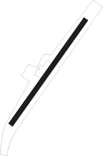
Runway 04 / 22
 length619m (2031ft)
 bearing51° / 231°
 width25m (82ft)
 surfacegrass

Airport layout


Nearby beacons

codeidentifierdistbearingfrequency
KIKLAGENFURT NDB6.327°313
KFTKLAGENFURT NDB1066°374
KFTKLAGENFURT VOR/DME10.274°113.10
LBLLJUBLJANA VOR/DME18.1162°117.20
VIWDME19.7291°112.90
MGLJUBLJANA NDB23.5148°296
KORDME30.468°109.40
DOLDOLSKO VOR/DME32.7135°112.70
ZWZELTWEG NDB43.533°418
RCHRONCHI DEI LEGIONARI VOR/DME55.1230°114.20
RONRONCHI DEI LEGIONARI NDB58.4234°396
ILBBISTRICA VOR/DME58.5189°114.80

Disclaimer

The information on this website is not for real aviation. Use this data with the X-Plane flight simulator only! Data taken with kind consent from X-Plane 12 source code and data files. Content is subject to change without notice.