Lienz - Lienz-nikolsdorf
Airport details
| Country | Austria |
| State | Tyrol |
| Region | LO |
| Airspace | Vienna Ctr |
| Municipality | Gemeinde Nikolsdorf |
| Elevation | 2090ft (637m) |
| Timezone | GMT +1 |
| Coordinates | 46.79976, 12.87682 |
| Magnetic var | |
| Type | land |
| Available since | X-Plane v10.40 |
| ICAO code | LOKL |
| IATA code | n/a |
| FAA code | n/a |
Communication
| Lienz-Nikolsdorf CTAF | 122.500 |
Nearby Points of Interest:
Nikolsdorf, Kath. Pfarrkirche hl. Bartholomäus
-Pfarrkirche Dölsach
-Wallfahrtskirche St. Chrysanthen
-Debanter Pfarrkirche
-Wallfahrtskirche Maria Rosenkranzkönigin, Oberdrauburg
-Filialkirche Reintal, Winklern
-Nußdorfer Pfarrkirche
-Pfarrkirche Tristach
-Franz-Joseph-Kaserne Lienz
-Liebburg, Lienz
-Franziskanerkirche, Lienz
-Pfarrkirche Gaimberg
-Hospital Lienz
-Dominikanerinnenkloster Lienz
-Filialkirche Maria in den Auen
-Filialkirche St. Helene Oberdrum
-St. Josef
-Pfarrkirche Oberlienz
-Pfarrkirche Irschen
-Kornat, Kath Pfarrkirche hl. Johannes der Täufer
-St. Nikolaus (Liesing)
-St. Lorenzen im Lesachtal, Kath. Pfarrkirche hl. Laurentius
-Kirche Sankt Radegund, Wiesen
-Pfarrkirche Mörtschach
-Pfarrkirche St. Jakob im Lesachtal
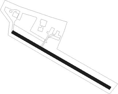
Runway info
| Runway 12 / 30 | ||
| length | 621m (2037ft) | |
| bearing | 115° / 295° | |
| width | 18m (59ft) | |
| surface | asphalt | |
| displ threshold | 70m (230ft) / 50m (164ft) | |
Nearby beacons
| code | identifier | dist | bearing | frequency |
|---|---|---|---|---|
| AVI | AVIANO TACAN | 47.8 | 201° | 116.40 |
| RIV | RIVOLTO TACAN | 49 | 165° | 110 |
| RIV | RIVOLTO NDB | 51.9 | 176° | 371 |
| RTT | RATTENBERG NDB | 53.8 | 304° | 303 |
| AVI | AVIANO NDB | 55.7 | 207° | 390 |
| RON | RONCHI DEI LEGIONARI NDB | 61.6 | 154° | 396 |
| RCH | RONCHI DEI LEGIONARI VOR/DME | 63.4 | 148° | 114.20 |
Disclaimer
The information on this website is not for real aviation. Use this data with the X-Plane flight simulator only! Data taken with kind consent from X-Plane 12 source code and data files. Content is subject to change without notice.