Freistadt
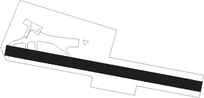
Airport details
| Country | Austria |
| State | Upper Austria |
| Region | LO |
| Airspace | Vienna Ctr |
| Municipality | Hirschbach im Mühlkreis |
| Elevation | 2235ft (681m) |
| Timezone | GMT +1 |
| Coordinates | 48.51472, 14.40889 |
| Magnetic var | |
| Type | land |
| Available since | X-Plane v10.40 |
| ICAO code | LOLF |
| IATA code | n/a |
| FAA code | n/a |
Communication
| Freistadt Freistadt Flugplatz | 122.325 |
Nearby Points of Interest:
Braucommune Freistadt
-Linzertor
-Gymnasium Freistadt
-Castle Kinsky in Freistadt
-St. John the Baptist church in Reichenau im Mühlkreis
-Thurytal
-Bezirksgericht Leonfelden
-Bürgerspital
-Spitalkirche Bad Leonfelden
-Burgruine Kronest
-Church of Saint Michael (Horní Dvořiště)
-Pfarrkirche Mariä Himmelfahrt, Zwettl an der Rodl
-Wallfahrtskirche hl. Wolfgang (Kefermarkt)
-Jez s vorovou propustí
-Sankt Peter und Paul
-Stiftervilla Kirchschlag
-Saint Joseph the Worker church
-Church of Saint Mary
-Alt-Hagenberg
-Church of Saint Andrew
-Stadtpfarrkirche Gallneukirchen
-Christuskirche Gallneukirchen
-St.Vitus in St.Veit im Mühlkreis
-Pfarrkirche Christus der Auferstandene, Engerwitzdorf
-Saint Anne Church
Nearby beacons
| code | identifier | dist | bearing | frequency |
|---|---|---|---|---|
| FRE | DME | 12.1 | 253° | 113.50 |
| LNZ | LINZ NDB | 17 | 197° | 327 |
| LNZ | LINZ VOR/DME | 21 | 227° | 116.60 |
Disclaimer
The information on this website is not for real aviation. Use this data with the X-Plane flight simulator only! Data taken with kind consent from X-Plane 12 source code and data files. Content is subject to change without notice.