Airports for X-Plane offers a convenient way to explore airports and their related communication information for the X-Plane flight simulator. It only uses data from the X-Plane flight simulator itself, and is therefore more reliable than the data that comes from real aviation websites. You can search for airports by using the ICAO code, or browse for airports per country and state. The information displayed is categorized by airport details, runway information, airport communication, approach frequencies (ILS and Glidepath details), details of nearby beacons, SIDs, STARs and approach procedures.

takeoff port passengers airspace airport check-in jetliner regional public transport kennedy hospital airline downtown rail aircraft carrier capital air safety outskirts metro airliner landing

St. Georgen Am Ybbsfelde - St Georgen Am Ybbsfeld

Airport details

CountryAustria
StateLower Austria
RegionLO
AirspaceVienna Ctr
MunicipalityGemeinde Sankt Georgen am Ybbsfelde
Elevation828ft (252m)
TimezoneGMT +1
Coordinates48.10333, 14.95000
Magnetic var
Typeland
Available sinceX-Plane v10.40
ICAO codeLOLG
IATA coden/a
FAA coden/a

Communication

St Georgen am Ybbsfeld St Georgen Flugplatz122.405
Nearby Points of Interest:
Schloss Freidegg
-
Pfarrkirche Euratsfeld
-
Schloss Auhof Blindenmarkt
-
Filialkirche Innerochsenbach
-
Filialkirche Eisenreichdornach
-
Schloss Edla
-
Pfarrkirche hl. Nikolaus Neumarkt an der Ybbs
-
Schloss Ernegg
-
Pfarrkirche hl. Maria Unbefleckte Empfängnis, Randegg
-
Wallfahrtskirche Kollmitzberg
-
Schloss Zeillern
-
Pfarrkirche hl. Jakobus der Ältere, Zeillern
-
Hexenstein
-
Kath. Filialkirche hl. Nikolaus
-
Ybbs Pflegezentrum
-
Weinzierl castle
-
Pfarrkirche Wieselburg
-
Ehem. Marktschloss
-
Ehemalige Marienkirche in Struden
-
Pfarrkirche Gottsdorf
-
Rottenhof castle
-
Kaffeesiederei Blumensträußl, Grein
-
Sankt Ägidius
-
Pfarrkirche Säusenstein
-
Catholic Church in Petzenkirchen

Runway info

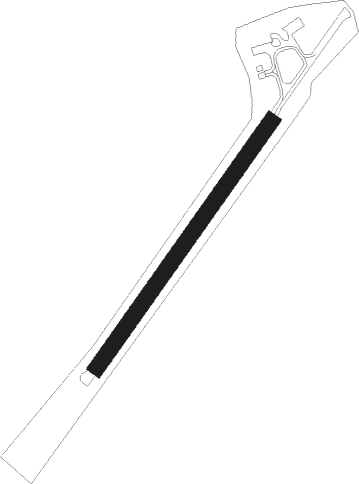
Runway 04 / 22
 length478m (1568ft)
 bearing51° / 231°
 width25m (82ft)
 surfacegrass

Airport layout


Parking locations

Nearby beacons

codeidentifierdistbearingfrequency
LNZLINZ NDB26.4282°327
LNZLINZ VOR/DME34.7278°116.60
FREDME38.2292°113.50
ZWZELTWEG NDB54.9192°418
OKFDESNA VOR/DME57.135°113.15
RAWDME59.5135°112.15

Disclaimer

The information on this website is not for real aviation. Use this data with the X-Plane flight simulator only! Data taken with kind consent from X-Plane 12 source code and data files. Content is subject to change without notice.