Hofkirchen
Airport details
| Country | Austria |
| State | Upper Austria |
| Region | LO |
| Airspace | Vienna Ctr |
| Municipality | Hofkirchen im Traunkreis |
| Elevation | 1166ft (355m) |
| Timezone | GMT +1 |
| Coordinates | 48.14000, 14.33833 |
| Magnetic var | |
| Type | land |
| Available since | X-Plane v10.40 |
| ICAO code | LOLH |
| IATA code | n/a |
| FAA code | n/a |
Communication
| Hofkirchen Hofkirchen Flugplatz | 122.180 |
Nearby Points of Interest:
Pfarrkirche Maria Namen in Sankt Marien
-Pfarrkirche Dietach
-Kath. Pfarrkirche hl. Matthäus, Neuhofen an der Krems
-Filialkirche Stadlkirchen
-Landwirtschaftliche Berufs- und Fachschule Ritzlhof
-Sankt Valentin (Ansfelden)
-Oberösterreichische Glocken- und Metallgießerei
-Burg Volkenstorf, Tillysburg
-Pfarrkirche Heiliger Vitus (Berg an der Krems)
-Kronstorfer Brucknerzimmer
-Schloss Schieferegg
-Pfarrkirche Asten
-Pfarrkirche hl. Stephan, Sierning
-Saint Severin Church
-Sankt Leonhard
-Katholische Pfarrkirche Traun
-Steyr Annaberg 6
-Pfarrkirche Ebelsberg
-Evangelische Pfarrkirche Traun
-Hiller-Kaserne
-Wehrgraben (Steyr)
-Jüdischer Friedhof Steyr
-Neue Pfarrkirche Münichholz
-Bürgerspital
-Schloss Vogelsang (Steyr)
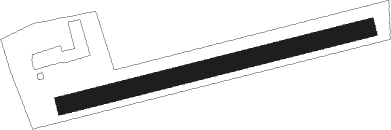
Runway info
| Runway 08 / 26 | ||
| length | 447m (1467ft) | |
| bearing | 84° / 264° | |
| width | 25m (82ft) | |
| surface | grass | |
Nearby beacons
| code | identifier | dist | bearing | frequency |
|---|---|---|---|---|
| LNZ | LINZ NDB | 5.8 | 350° | 327 |
| LNZ | LINZ VOR/DME | 10.8 | 291° | 116.60 |
| FRE | DME | 19.4 | 324° | 113.50 |
| ZW | ZELTWEG NDB | 59 | 156° | 418 |
Disclaimer
The information on this website is not for real aviation. Use this data with the X-Plane flight simulator only! Data taken with kind consent from X-Plane 12 source code and data files. Content is subject to change without notice.