Micheldorf
Airport details
| Country | Austria |
| State | Upper Austria |
| Region | LO |
| Airspace | Vienna Ctr |
| Municipality | Micheldorf in Oberösterreich |
| Elevation | 1508ft (460m) |
| Timezone | GMT +1 |
| Coordinates | 47.87083, 14.12500 |
| Magnetic var | |
| Type | land |
| Available since | X-Plane v10.40 |
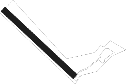
| ICAO code | LOLM |
| IATA code | n/a |
| FAA code | n/a |
Communication
| Micheldorf Micheldorf Flugplatz | 123.205 |
Nearby Points of Interest:
Sensenschmiede an der Zinne
-Pfarrkirche hl. Josef, Mittermicheldorf
-Steinhuberhammer
-Herrenhaus
-Evangelische Pfarrkirche Kirchdorf an der Krems
-Schloss Neupernstein
-Stadtpfarrkirche Kirchdorf an der Krems
-Pfarrkirche Klaus an der Pyhrnbahn
-Gemeindeamt Inzersdorf im Kremstal
-Filialkirche Inzersdorf im Kremstal
-Pfarrkirche Unbefleckte Empfängnis Mariä, Steyrling
-Pfarrkirche Steinbach am Ziehberg
-Schloss Dorff
-Ubald of Gubbio Church (Schlierbach, Austria)
-Burgruine Leonstein
-Pfarrkirche Scharnstein
-Pfarrkirche Viechtwang
-Pfarrkirche Grünburg
-Pfarrkirche hl. Pankraz, St. Pankraz, Upper Austria
-Kaplaneikirche hl. Josef, Molln
-Rameishammer
-Pfarrkirche hll. Peter und Paul, Waldneukirchen
-Saint Conrad of Constance Church
-Pfarrkirchen bei Bad Hall Tassiloquelle
-Evangelische Pfarrkirche Bad Hall
Nearby beacons
| code | identifier | dist | bearing | frequency |
|---|---|---|---|---|
| LNZ | LINZ VOR/DME | 21.5 | 357° | 116.60 |
| LNZ | LINZ NDB | 23.3 | 28° | 327 |
| FRE | DME | 33.6 | 0° | 113.50 |
| ZW | ZELTWEG NDB | 47.8 | 137° | 418 |
Disclaimer
The information on this website is not for real aviation. Use this data with the X-Plane flight simulator only! Data taken with kind consent from X-Plane 12 source code and data files. Content is subject to change without notice.