Airports for X-Plane offers a convenient way to explore airports and their related communication information for the X-Plane flight simulator. It only uses data from the X-Plane flight simulator itself, and is therefore more reliable than the data that comes from real aviation websites. You can search for airports by using the ICAO code, or browse for airports per country and state. The information displayed is categorized by airport details, runway information, airport communication, approach frequencies (ILS and Glidepath details), details of nearby beacons, SIDs, STARs and approach procedures.

airdrome helicopters grass stopover flights airdock luggage rail transport frankfurt airport consulate city hospital aircraft carrier aerodromes air safety heliport taxiway stol runway airbase

Mauterndorf

Airport details

CountryAustria
StateSalzburg
RegionLO
AirspaceVienna Ctr
MunicipalityMauterndorf
Elevation3642ft (1110m)
TimezoneGMT +1
Coordinates47.13333, 13.69667
Magnetic var
Typeland
Available sinceX-Plane v10.40
ICAO codeLOSM
IATA coden/a
FAA coden/a

Communication

Mauterndorf Mauterndorf Flugplatz122.850
Nearby Points of Interest:
Pfarrkirche Unternberg
-
Heihsgut
-
Schloss Kuenburg
-
Ansitz Barbarahof
-
Town hall of Tamsweg
-
Ledererhaus, Tamsweg
-
Pfarrkirche Lessach
-
Ramingstein Schloss Wintergrün
-
Filialkirche Obertauern
-
Saints Primus and Felician church in Predlitz, Austria
-
Schloss Dornbach
-
Pfarrkirche zum Hl. Leonhard, Forstau
-
Filialkirche Trebesing
-
Mandlingpass
-
Jagdschloss Kleinarl
-
Lodenwalker
-
Kath. Pfarrkirche Mariae Himmelfahrt, Radstadt
-
Filialkirche heiliger Johannes der Täufer
-
Sankt Oswald in Bad Kleinkirchheim
-
Pfarrkirche hl. Johannes d. T., Kaning
-
Hl. Katharina im Bade, Bad Kleinkirchheim
-
Saints Peter and Paul Church (Filzmoos)
-
Schloss Thannegg
-
Saint Ulrich of Augsburg Church (Bad Kleinkirchheim)
-
Pfarrkirche Heiliger Nikolaus, Radenthein

Runway info

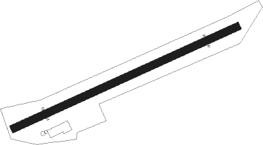
Runway 07 / 25
 length816m (2677ft)
 bearing76° / 256°
 width25m (82ft)
 surfacegrass
 displ threshold120m (394ft) / 120m (394ft)

Airport layout


Nearby beacons

codeidentifierdistbearingfrequency
VIWDME27.7153°112.90
KIKLAGENFURT NDB41.1126°313
KFTKLAGENFURT NDB45.9121°374
GSBDME46.8319°109.45
KFTKLAGENFURT VOR/DME47.9122°113.10
SISALZBURG NDB50.2314°410
SBGSALZBURG NDB59.7316°382
SBGSALZBURG VOR/DME61.5317°113.80
LBLLJUBLJANA VOR/DME61.6141°117.20
MGLJUBLJANA NDB67.6138°296

Disclaimer

The information on this website is not for real aviation. Use this data with the X-Plane flight simulator only! Data taken with kind consent from X-Plane 12 source code and data files. Content is subject to change without notice.