Beja
Airport details
| Country | Portugal |
| State | Beja District |
| Region | LP |
| Airspace | Lisbon Ctr |
| Municipality | Beja |
| Elevation | 636ft (194m) |
| Timezone | GMT +0 |
| Coordinates | 38.06477, -7.92970 |
| Magnetic var | |
| Type | land |
| Available since | X-Plane v10.40 |
| ICAO code | LPBJ |
| IATA code | BYJ |
| FAA code | n/a |
Communication
| Beja Ground Control | 120.700 |
| Beja Tower | 130.400 |
| Beja Tower | 122.100 |
| Beja Approach | 130.100 |
Approach frequencies
| ILS-cat-I | RW19R | 110.3 | 18.00mi |
| 3° GS | RW19R | 110.3 | 18.00mi |
Nearby Points of Interest:
Igreja Paroquial de Ferreira do Alentejo
-Capela de Santa Luzia
-Igreja de Nossa Senhora da Assunção (Torrão)
-Castelo de Messejana
-Igreja Matriz de Casével
-Atalaia Magra
-Mercado Municipal de Castro Verde
-Igreja Matriz de Castro Verde
-CTT de Castro Verde
-Moinho de Vento em Castro Verde
-Castle of Esporão
-Ponte de Mértola
-Cerro do Castelo
-Igreja Paroquial de São Brissos
-Mértola
-Ponte do Lagar da Boa Fé
-Igreja e Convento de Nossa Senhora dos Remédios
-Cerca medieval (Évora)
-Church of the Lóios
-Centro Histórico de Évora
-Castelo de Évora
-Castle of Lousa
-Arco romano de Dona Isabel
-Porta de Avis (Évora)
-Convento de São Bento de Cástris (Évora)
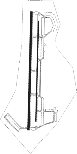
Runway info
Runway 01L / 19R  | ||
| length | 3456m (11339ft) | |
| bearing | 8° / 188° | |
| width | 60m (197ft) | |
| surface | concrete | |
| blast zone | 255m (837ft) / 255m (837ft) | |
| Runway 01R / 19L | ||
| length | 2956m (9698ft) | |
| bearing | 7° / 187° | |
| width | 30m (98ft) | |
| surface | concrete | |
| blast zone | 245m (804ft) / 254m (833ft) | |
Nearby beacons
| code | identifier | dist | bearing | frequency |
|---|---|---|---|---|
| BEJ | BEJA TACAN | 3.8 | 3° | 115.80 |
| DML | RUIVA DME | 23.2 | 155° | 114.50 |
| EVR | EVORA NDB | 27.9 | 5° | 425 |
| DPR | DME-ILS | 40.4 | 151° | 111.50 |
| DSL | DME-ILS | 45.5 | 182° | 109.30 |
| DMX | GRANDE DME-ILS | 63.2 | 217° | 108.50 |
Departure and arrival routes
| Transition altitude | 4000ft |
| SID end points | distance | outbound heading | |
|---|---|---|---|
| RW01L | |||
| EVUR1N | 36mi | 1° | |
| ROSA1N | 39mi | 93° | |
| XAPA1N | 28mi | 182° | |
| GAIO1N | 32mi | 289° | |
| RW19R | |||
| EVUR1S | 36mi | 1° | |
| ROSA1S | 39mi | 93° | |
| XAPA1S | 28mi | 182° | |
| GAIO1S | 32mi | 289° | |
Disclaimer
The information on this website is not for real aviation. Use this data with the X-Plane flight simulator only! Data taken with kind consent from X-Plane 12 source code and data files. Content is subject to change without notice.