Castelo Branco
Airport details
| Country | Portugal |
| State | Castelo Branco District |
| Region | LP |
| Airspace | Lisbon Ctr |
| Municipality | Castelo Branco |
| Elevation | 1250ft (381m) |
| Timezone | GMT +0 |
| Coordinates | 39.84833, -7.44167 |
| Magnetic var | |
| Type | land |
| Available since | X-Plane v10.40 |
| ICAO code | LPCB |
| IATA code | n/a |
| FAA code | n/a |
Communication
| Castelo Branco CTAF | 122.500 |
Nearby Points of Interest:
Solar dos Cardosos
-Casa na Rua Arco do Bispo, n.º 14
-Arquivo Distrital de Castelo Branco
-Ponte de Portas de Ródão
-Castelo de Idanha-a-Velha
-Egitania
-Muralha romana de Idanha-a-Velha
-Ponte de Segura
-Castelo de Nisa
-Oleiros
-Penamacor
-Marvão-Beirã train station
-Castelo de Salvaterra do Extremo
-Ponte da Ribeira de Meimoa
-Meimoa
-Fonte da Vila (Castelo de Vide)
-Muralhas da Cidade da Covilhã
-San Benito de Alcántara
-Barrio Gótico de Valencia de Alcántara
-Pillory of Sertã
-Church of São Pedro
-Castelo da Sertã
-Convento de Santo António (Sertã)
-Convento de Nossa Senhora da Boa Esperança
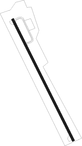
Runway info
| Runway 16 / 34 | ||
| length | 1521m (4990ft) | |
| bearing | 152° / 332° | |
| width | 30m (98ft) | |
| surface | asphalt | |
| displ threshold | 0m (0ft) / 64m (210ft) | |
Nearby beacons
| code | identifier | dist | bearing | frequency |
|---|---|---|---|---|
| NSA | NISA VOR/DME | 27.7 | 239° | 115.50 |
| VIS | VISEU VOR/DME | 56.3 | 333° | 113.10 |
| DMT | DME | 57.7 | 224° | 110.80 |
| TBC | BADAJOZ TACAN | 64.3 | 147° | 108.80 |
| VBZ | BADAJOZ VOR/DME | 64.4 | 147° | 116.80 |
Disclaimer
The information on this website is not for real aviation. Use this data with the X-Plane flight simulator only! Data taken with kind consent from X-Plane 12 source code and data files. Content is subject to change without notice.