Coimbra
Airport details
| Country | Portugal |
| State | Distrito de Coimbra |
| Region | LP |
| Airspace | Lisbon Ctr |
| Municipality | Coimbra |
| Elevation | 568ft (173m) |
| Timezone | GMT +0 |
| Coordinates | 40.15611, -8.46917 |
| Magnetic var | |
| Type | land |
| Available since | X-Plane v10.40 |
| ICAO code | LPCO |
| IATA code | n/a |
| FAA code | n/a |
Communication
| Coimbra Coimbra Radio | 122.900 |
Nearby Points of Interest:
Palácio dos Figueiredos
-Seminário Maior de Coimbra
-Paços da Universidade ou Paços das Escolas
-University of Coimbra General Library
-Faculdade de Letras da Universidade de Coimbra
-Aqueduto de São Sebastião
-Igreja de São João das Donas
-Jardim da Manga
-Mata Nacional de Vale de Canas
-Santuário do Senhor da Serra
-Igreja Matriz de Santo Varão
-Miranda do Corvo
-Ançã
-Capela da Misericórdia de Montemor-o-Velho
-Palácio dos Salazares
-Paço de Maiorca
-Buçaco Forest
-Complexo Termal do Luso
-Chapel of Seiça
-Góis
-Casulo (Figueiró dos Vinhos)
-Igreja de São João Baptista (Figueiró dos Vinhos)
-Palácio da Justiça
-Casino Oceano
-Fortim dos Palheiros
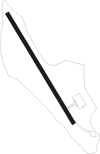
Runway info
| Runway 16 / 34 | ||
| length | 924m (3031ft) | |
| bearing | 147° / 327° | |
| width | 30m (98ft) | |
| surface | asphalt | |
| blast zone | 34m (112ft) / 0m (0ft) | |
Nearby beacons
| code | identifier | dist | bearing | frequency |
|---|---|---|---|---|
| MTR | MONTE REAL TACAN | 27.4 | 232° | 109.60 |
| FTM | FATIMA VOR/DME | 29.4 | 183° | 113.50 |
| VIS | VISEU VOR/DME | 43.2 | 46° | 113.10 |
| NSA | NISA VOR/DME | 43.7 | 137° | 115.50 |
| OVR | OVAR TACAN | 44.6 | 347° | 110.60 |
| DAR | DME | 47.9 | 17° | 114.90 |
Disclaimer
The information on this website is not for real aviation. Use this data with the X-Plane flight simulator only! Data taken with kind consent from X-Plane 12 source code and data files. Content is subject to change without notice.