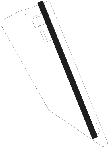
Airports for X-Plane offers a convenient way to explore airports and their related communication information for the X-Plane flight simulator. It only uses data from the X-Plane flight simulator itself, and is therefore more reliable than the data that comes from real aviation websites. You can search for airports by using the ICAO code, or browse for airports per country and state. The information displayed is categorized by airport details, runway information, airport communication, approach frequencies (ILS and Glidepath details), details of nearby beacons, SIDs, STARs and approach procedures.

control tower jet helipad air traffic control terminal train gravel transit hospital taxi airfield aircraft consulate kennedy airdrome newark regional airport apron government airports

Mirandela

Airport details

CountryPortugal
StateBragança District
RegionLP
AirspaceLisbon Ctr
MunicipalityMirandela
Elevation1320ft (402m)
TimezoneGMT +0
Coordinates41.47028, -7.22778
Magnetic var
Typeland
Available sinceX-Plane v10.40
ICAO codeLPMI
IATA coden/a
FAA coden/a

Communication

Mirandela ATIS122.200
Nearby Points of Interest:
Paço dos Távoras
-
Pelourinho de Mirandela
-
Castle of Mirandela
-
Church of São Miguel
-
Igreja de São Tomé de Abambres
-
Antiga Forca de Freixiel
-
Church of São Pedro
-
Castle of Vila Flor
-
Igreja de Guide
-
Conjunto formado pela estrada romana e ponte sobre o rio Tinhela
-
Ponte de Torre de Dona Chama
-
Alfândega da Fé
-
Igreja Paroquial de Friões
-
Casa de Selores
-
Igreja de São Salvador de Ansiães
-
Igreja da Misericórdia de Chaves
-
Castle of Chaves
-
Biblioteca Municipal de Chaves
-
Escola Industrial e Comercial de Chaves
-
Alto Douro Wine Region
-
Ponte de Piscais
-
Castle of Vinhais
-
Cruzeiro de Castelões
-
Solar da família Caiado Ferrão
-
Igreja Matriz de Santa Marinha de Trevões

Runway info

Runway 17 / 35
 length751m (2464ft)
 bearing157° / 337°
 width30m (98ft)
 surfaceasphalt
 displ threshold34m (112ft) / 36m (118ft)

Airport layout


Parking locations

Nearby beacons

codeidentifierdistbearingfrequency
DMRDME32.5251°114.60
DMUDME48289°113.80
VISVISEU VOR/DME53.8221°113.10
DARDME55.4242°114.90

Disclaimer

The information on this website is not for real aviation. Use this data with the X-Plane flight simulator only! Data taken with kind consent from X-Plane 12 source code and data files. Content is subject to change without notice.