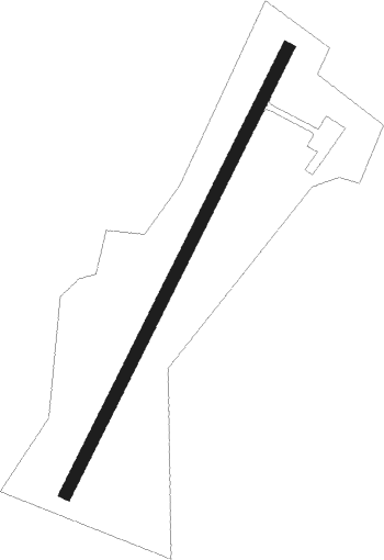
Montemor-o-novo - Amendoeira
Airport details
| Country | Portugal |
| State | [Other] |
| Region | LP |
| Airspace | Lisbon Ctr |
| Municipality | Foros de Vale de Figueira |
| Elevation | 636ft (194m) |
| Timezone | GMT +0 |
| Coordinates | 38.70917, -8.27528 |
| Magnetic var | |
| Type | land |
| Available since | X-Plane v10.32 |
| ICAO code | LPMN |
| IATA code | n/a |
| FAA code | n/a |
Communication
Nearby Points of Interest:
Conjunto constituído pela Igreja e Convento de São Francisco
-Ponte do Lagar da Boa Fé
-Igreja Paroquial de São Brissos
-Igreja e Hospital da Misericórdia do Cabeção
-Convento de São Bento de Cástris (Évora)
-Arco romano de Dona Isabel
-Cerca medieval (Évora)
-Igreja e Convento de Nossa Senhora dos Remédios
-Porta de Avis (Évora)
-Centro Histórico de Évora
-Castelo de Évora
-Church of the Lóios
-Igreja de Nossa Senhora do Espinheiro
-Igreja de Nossa Senhora da Assunção (Torrão)
-Castle of Avis
-Pelourinho de Avis
-Ponte de Ervedal
-Capela de Santa Luzia
-Portal da Gafaria
-Igreja de São Julião (Setúbal)
-Setúbal Aqueduct
-Casa das Quatro Cabeças
-Palácio Feu Guião
Nearby beacons
| code | identifier | dist | bearing | frequency |
|---|---|---|---|---|
| EVR | EVORA NDB | 20.9 | 115° | 425 |
| DMT | DME | 22.4 | 13° | 110.80 |
| ARR | DME-ILS | 34.7 | 253° | 108.30 |
| MOJ | MONTIJO TACAN | 35.5 | 270° | 110 |
| BEJ | BEJA TACAN | 38.5 | 149° | 115.80 |
| LAR | ARRUDA (LISBON) NDB | 39.6 | 290° | 382 |
| LIS | LISBON VOR/DME | 42.9 | 281° | 114.80 |
| ESP | ESPICHEL VOR/DME | 46 | 253° | 112.50 |
| NSA | NISA VOR/DME | 54 | 23° | 115.50 |
| FTM | FATIMA VOR/DME | 58.3 | 347° | 113.50 |
Disclaimer
The information on this website is not for real aviation. Use this data with the X-Plane flight simulator only! Data taken with kind consent from X-Plane 12 source code and data files. Content is subject to change without notice.