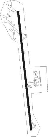
Vila Baleira - Porto Santo
Airport details
| Country | Portugal |
| State | Autonomous Region of Madeira |
| Region | LP |
| Airspace | Lisbon Ctr |
| Municipality | Porto Santo |
| Elevation | 335ft (102m) |
| Timezone | GMT +0 |
| Coordinates | 33.07084, -16.34972 |
| Magnetic var | |
| Type | land |
| Available since | X-Plane v10.40 |
| ICAO code | LPPS |
| IATA code | PXO |
| FAA code | n/a |
Communication
| Porto Santo Tower | 120.500 |
| Porto Santo Approach | 119.600 |
Nearby beacons
| code | identifier | dist | bearing | frequency |
|---|---|---|---|---|
| PST | PORTO SANTO NDB | 0.4 | 255° | 338 |
| STO | PORTO SANTO TACAN | 0.8 | 286° | 116.30 |
| SNT | PORTO SANTO VOR/DME | 1.1 | 357° | 114.90 |
| FUN | FUNCHAL VOR/DME | 26.4 | 228° | 112.20 |
Departure and arrival routes
| Transition altitude | 5000ft |
| SID end points | distance | outbound heading | |
|---|---|---|---|
| RW18 | |||
| DEGU1S | 41mi | 63° | |
| FAGU1S | 58mi | 187° | |
| PILI1S | 18mi | 228° | |
| ILCA1S | 41mi | 297° | |
| RW36 | |||
| DEGU1N | 41mi | 63° | |
| FAGU1N | 58mi | 187° | |
| PILI1N | 18mi | 228° | |
| ILCA1N | 41mi | 297° | |
| STAR starting points | distance | inbound heading | |
|---|---|---|---|
| RW18 | |||
| ILCA1G | 41.3 | 117° | |
| KICA1G | 41.2 | 170° | |
| LIDR1G | 41.0 | 214° | |
| RAKU1G | 40.8 | 229° | |
| EKNO1G | 53.7 | 357° | |
| RW36 | |||
| ILCA1H | 41.3 | 117° | |
| KICA1H | 41.2 | 170° | |
| LIDR1H | 41.0 | 214° | |
| RAKU1H | 40.8 | 229° | |
| EKNO1H | 53.7 | 357° | |
Disclaimer
The information on this website is not for real aviation. Use this data with the X-Plane flight simulator only! Data taken with kind consent from X-Plane 12 source code and data files. Content is subject to change without notice.
