Tancos
Airport details
| Country | Portugal |
| State | Santarem |
| Region | LP |
| Airspace | Lisbon Ctr |
| Municipality | Praia do Ribatejo |
| Elevation | 266ft (81m) |
| Timezone | GMT +0 |
| Coordinates | 39.47415, -8.37864 |
| Magnetic var | |
| Type | land |
| Available since | X-Plane v10.40 |
| ICAO code | LPTN |
| IATA code | n/a |
| FAA code | n/a |
Communication
| Tancos Tower | 122.100 |
Nearby Points of Interest:
Igreja da Misericórdia de Torres Novas
-Colégio Nun'Álvares de Tomar
-Convento de Santo António
-Casa da Câmara Municipal de Abrantes
-Hospital Velho da Misericórdia da Chamusca
-Antiga Igreja dos Terceiros de São Francisco
-Igreja Paroquial da Chamusca
-Aqueduto dos Pegões
-Ermida de Nossa Senhora do Pranto
-Conjunto de pilares na margem esquerda do rio Tejo
-Igreja de Nossa Senhora da Conceição (Louriceira)
-Moinhos Velhos Cave
-Sanctuary of Fátima
-Santarém bridge
-Convento de Santo António (Sertã)
-Castelo da Sertã
-Church of São Pedro
-Pillory of Sertã
-Paços do Concelho de Leiria
-Igreja de São João Baptista (Figueiró dos Vinhos)
-Casulo (Figueiró dos Vinhos)
-Capela de Nossa Senhora do Desterro
-Palácio de Pina Manique
-Termas da Piedade
-Igreja do Mosteiro de Nossa Senhora das Virtudes
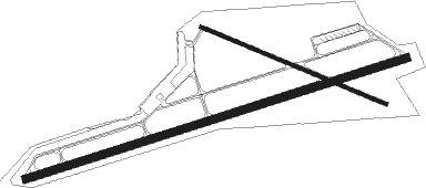
Runway info
Runway 08 / 26  | ||
| length | 2394m (7854ft) | |
| bearing | 80° / 260° | |
| width | 45m (148ft) | |
| surface | asphalt | |
| displ threshold | 99m (325ft) / 0m (0ft) | |
| Runway 12 / 30 | ||
| length | 1199m (3934ft) | |
| bearing | 112° / 292° | |
| width | 23m (74ft) | |
| surface | asphalt | |
| displ threshold | 69m (226ft) / 0m (0ft) | |
Nearby beacons
| code | identifier | dist | bearing | frequency |
|---|---|---|---|---|
| FTM | FATIMA VOR/DME | 12.6 | 329° | 113.50 |
| NSA | NISA VOR/DME | 22.1 | 79° | 115.50 |
| DMT | DME | 25.4 | 154° | 110.80 |
| MTR | MONTE REAL TACAN | 31.9 | 305° | 109.60 |
| LAR | ARRUDA (LISBON) NDB | 42.1 | 234° | 382 |
| LIS | LISBON VOR/DME | 50.7 | 233° | 114.80 |
| MOJ | MONTIJO TACAN | 55.1 | 221° | 110 |
| SRA | SINTRA VORTAC | 59.2 | 236° | 112.10 |
| EVR | EVORA NDB | 61.1 | 153° | 425 |
| CAS | CASCAIS VOR/DME | 63.2 | 234° | 114.30 |
| ARR | DME-ILS | 64.9 | 211° | 108.30 |
Disclaimer
The information on this website is not for real aviation. Use this data with the X-Plane flight simulator only! Data taken with kind consent from X-Plane 12 source code and data files. Content is subject to change without notice.