Maia - Vilar De Luz
Airport details
| Country | Portugal |
| State | Oporto District |
| Region | LP |
| Airspace | Lisbon Ctr |
| Municipality | Santo Tirso |
| Elevation | 773ft (236m) |
| Timezone | GMT +0 |
| Coordinates | 41.28223, -8.51525 |
| Magnetic var | |
| Type | land |
| Available since | X-Plane v10.40 |
| ICAO code | LPVL |
| IATA code | n/a |
| FAA code | n/a |
Communication
| Vilar de Luz Tower | 122.400 |
Nearby Points of Interest:
Casa e Quinta de Dinis de Cima
-Mosteiro de Landim
-Igreja de Santiago de Antas
-Quinta de Montezelo, Incluindo dois blocos de habitação, Capela de Nossa Senhora da Conceição e Magnólia
-Ponte de D. Goimil
-Anta do Padrão
-Instituto Superior de Engenharia do Porto
-Cavalete de São Vicente e instalação do Couto Mineiro
-Matadouro Industrial do Porto
-Praça de Nove de Abril
-Quinta da Bela-Vista
-Casa e Quinta de Bonjóia
-Quiosque na Praça Marquês de Pombal
-Casa da Prelada
-pestana palacio do freixo, pousada & national monument - the leading hotels of the world
-Casa da Pedra e Jardim
-Edifício Parnaso
-Junta de Freguesia do Bonfim
-Hospital Militar Regional n.º 1 (D. Pedro V)
-Porto-Boavista railway station
-Solar do Conde de Bolhão
-Municipal library
-Quiosque na Praça de Mouzinho de Albuquerque
-Quiosque no Largo Mompilher
-Devesas Factory Warehouse
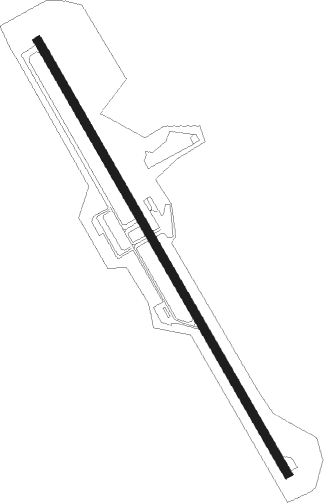
Runway info
| Runway 16 / 34 | ||
| length | 1708m (5604ft) | |
| bearing | 148° / 328° | |
| width | 29m (95ft) | |
| surface | asphalt | |
| displ threshold | 343m (1125ft) / 61m (200ft) | |
Nearby beacons
| code | identifier | dist | bearing | frequency |
|---|---|---|---|---|
| PRT | PORTO VOR/DME | 7.8 | 267° | 114.10 |
| OVR | OVAR TACAN | 24.4 | 198° | 110.60 |
| DAR | DME | 24.7 | 140° | 114.90 |
| DMR | DME | 28.4 | 93° | 114.60 |
| DSA | DME | 32.2 | 339° | 115.20 |
| DMU | DME | 34.9 | 31° | 113.80 |
| VIS | VISEU VOR/DME | 44 | 132° | 113.10 |
| VON | VIGO NDB | 54.5 | 352° | 433 |
Disclaimer
The information on this website is not for real aviation. Use this data with the X-Plane flight simulator only! Data taken with kind consent from X-Plane 12 source code and data files. Content is subject to change without notice.