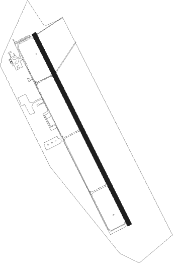
Mostar
Airport details
| Country | Bosnia and Herzegovina |
| State | Federation of Bosnia and Herzegovina |
| Region | LQ |
| Airspace | Sarajevo Ctr |
| Municipality | Mostar |
| Elevation | 153ft (47m) |
| Timezone | GMT +1 |
| Coordinates | 43.28290, 17.84588 |
| Magnetic var | |
| Type | land |
| Available since | X-Plane v10.40 |
| ICAO code | LQMO |
| IATA code | OMO |
| FAA code | n/a |
Communication
| Mostar ATIS | 126.225 |
| Mostar Mostar Tower | 129.875 |
| Mostar Mostar Tower | 125.550 |
| Mostar Mostar Approach | 129.875 |
| Mostar Mostar Approach | 120.225 |
| Mostar Monstar Departure | 129.875 |
| Mostar Monstar Departure | 120.225 |
Approach frequencies
| IGS | RW33 | 108.1 | 18.00mi |
| 3.4° GS | RW33 | 108.1 | 18.00mi |
Nearby beacons
| code | identifier | dist | bearing | frequency |
|---|---|---|---|---|
| MSR | MOSTAR VOR/DME | 1.3 | 155° | 116.90 |
| MA | MOSTAR NDB | 3.9 | 172° | 355 |
| DNC | MOSTAR NDB | 8.7 | 179° | 425 |
| GAC | GACKO NDB | 32.2 | 101° | 370 |
| KLP | KOLOCEP NDB | 37.6 | 164° | 318 |
| AS | SARAJEVO NDB | 38.7 | 40° | 381 |
| KG | KOBILJACA (SARAJEVO) NDB | 38.7 | 29° | 357 |
| IL | SARAJEVO NDB | 38.8 | 42° | 405 |
| CV | CAVTAT (DUBROVNIK) NDB | 44.8 | 152° | 397 |
| KIS | SARAJEVO VOR/DME | 45.1 | 16° | 116 |
| KEB | SARAJEVO VOR/DME | 47 | 43° | 116.70 |
| SAR | SARAJEVO NDB | 47.2 | 43° | 375 |
| DBK | DUBROVNIK VOR/DME | 47.7 | 149° | 115.40 |
| GR | GRUDA (DUBROVNIK) NDB | 49.2 | 147° | 414 |
| RO | TIVAT NDB | 60.4 | 141° | 332 |
Departure and arrival routes
| Transition altitude | 10000ft |
| SID end points | distance | outbound heading | |
|---|---|---|---|
| RW15 | |||
| KEB1A, KEB1B | 47mi | 43° | |
| GAC1K | 32mi | 101° | |
| MADO1B, MADO1A | 45mi | 149° | |
| GEBN1K | 31mi | 149° | |
| NETK1A, NETK1B, NETK1K | 17mi | 217° | |
| VELI1K, VELI1B, VELI1A | 25mi | 277° | |
| VRAN1A, VRAN1B, VRAN1K | 31mi | 327° | |
| STAR starting points | distance | inbound heading | |
|---|---|---|---|
| RW33 | |||
| NETK1A | 16.5 | 37° | |
| VELI1A, VELI1B | 25.1 | 97° | |
| VRAN1A | 31.2 | 147° | |
| XELM1A | 23.0 | 224° | |
| GEBN1A | 31.4 | 329° | |
Instrument approach procedures
| runway | airway (heading) | route (dist, bearing) |
|---|---|---|
| RW33 | LIZIN (329°) | LIZIN 6000ft POPPE (6mi, 269°) 4500ft MO33F (5mi, 358°) 4000ft |
| RW33 | MO33F (356°) | MO33F 6000ft ASLIL (6mi, 274°) 6000ft OBANE (6mi, 178°) 6000ft POPPE (6mi, 89°) 4500ft MO33F (5mi, 358°) 4000ft |
| RW33 | OBANE (24°) | OBANE 6000ft POPPE (6mi, 89°) 4500ft MO33F (5mi, 358°) 4000ft |
| RW33 | POPPE (356°) | POPPE 4500ft MO33F (5mi, 358°) 4000ft |
| RNAV | MO33F 4000ft MOM01 (9mi, 358°) 800ft ASLIL (10mi, 224°) OBANE (6mi, 178°) POPPE (6mi, 89°) MO33F (5mi, 358°) 6000ft MO33F (turn) 6000ft |
Holding patterns
| STAR name | hold at | type | turn | heading* | altitude | leg | speed limit |
|---|---|---|---|---|---|---|---|
| BARI1A | BARIT | VHF | right | 29 (209)° | 8500ft - 15500ft | 1.0min timed | 185 |
| VELI1A | SEZAN | VHF | left | 335 (155)° | 8600ft - 15500ft | 1.0min timed | 185 |
| XELM1A | BARIT | VHF | right | 29 (209)° | 8500ft - 15500ft | 1.0min timed | 185 |
| *) magnetic outbound (inbound) holding course | |||||||
Disclaimer
The information on this website is not for real aviation. Use this data with the X-Plane flight simulator only! Data taken with kind consent from X-Plane 12 source code and data files. Content is subject to change without notice.
