Ecuvillens
Airport details
| Country | Switzerland |
| State | Fribourg |
| Region | LS |
| Airspace | Switzerland Ctr |
| Municipality | Hauterive (FR) |
| Elevation | 2291ft (698m) |
| Timezone | GMT +1 |
| Coordinates | 46.75500, 7.07611 |
| Magnetic var | |
| Type | land |
| Available since | X-Plane v10.40 |
| ICAO code | LSGE |
| IATA code | n/a |
| FAA code | n/a |
Communication
| Ecuvillens AFIS | 118.975 |
Nearby Points of Interest:
Notre-Dame-de-la-Visitation chapel
-Hauterive
-Vers-Saint-Pierre former parish church
-St. Vincent church
-Ste-Apolline Bridge and Chapel
-Château de la Grande Riedera
-Fribourg State Archives
-Fribourg
-farmhouse at route de l’ Église 57, Praroman
-Vieux Presbytère, Praroman-Le Mouret
-Bible and Orient Museum
-Standseilbahn Neuveville–Saint-Pierre
-Fribourg Cantonal and University Library
-Fribourg museum of art and history
-Convent of the Visitation, Fribourg
-Espace Jean-Tinguely–Niki-de-Saint-Phalle
-Municipal archive Fribourg
-Pont du Gottéron
-Corbières
-Landsitz Montenach
-Villarzel
-Église Notre-Dame de Payerne
-Payerne
-Romont
-Aventicum
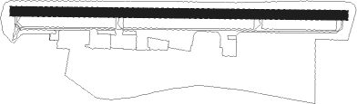
Runway info
| Runway 09 / 27 | ||
| length | 789m (2589ft) | |
| bearing | 94° / 274° | |
| width | 23m (75ft) | |
| surface | asphalt | |
Nearby beacons
| code | identifier | dist | bearing | frequency |
|---|---|---|---|---|
| FRI | FRIBOURG VOR/DME | 6.2 | 81° | 110.85 |
| LPS | LES EPLATURES NDB | 22.8 | 319° | 403 |
| LAP | PRAZ DME | 27.6 | 263° | 110.65 |
| GRE | GRENCHEN VOR/DME | 29.2 | 39° | 115.45 |
| SPR | ST PREX VOR/DME | 31 | 245° | 113.90 |
| SIO | SION VOR/DME | 33.5 | 158° | 112.15 |
| GLA | GLAND NDB | 40.1 | 247° | 375 |
| WIL | WILLISAU VOR/DME | 42.4 | 63° | 116.90 |
| MB | MONTBELIARD NDB | 45.4 | 349° | 330 |
| BSV | BESANCON NDB | 47.1 | 300° | 370 |
| HOC | DME | 49 | 40° | 113.20 |
| GVA | GENEVA VOR/DME | 49.2 | 242° | 115.75 |
| HR | HERICOURT NDB | 50.4 | 337° | 289 |
| BS | BASLE-MULHOUSE NDB | 52.9 | 29° | 376 |
| BLM | BASLE-MULHOUSE VOR/DME | 55.4 | 26° | 117.45 |
| BN | BASLE-MULHOUSE NDB | 56.8 | 24° | 353 |
| LUL | LUXEUIL VOR | 64.4 | 320° | 117.10 |
Disclaimer
The information on this website is not for real aviation. Use this data with the X-Plane flight simulator only! Data taken with kind consent from X-Plane 12 source code and data files. Content is subject to change without notice.