Reichenbach
Airport details
| Country | Switzerland |
| State | Bern |
| Region | LS |
| Airspace | Switzerland Ctr |
| Municipality | Reichenbach im Kandertal |
| Elevation | 2361ft (720m) |
| Timezone | GMT +1 |
| Coordinates | 46.61361, 7.67778 |
| Magnetic var | |
| Type | land |
| Available since | X-Plane v10.40 |
| ICAO code | LSGR |
| IATA code | n/a |
| FAA code | n/a |
Communication
| Reichenbach AFIS | 127.700 |
Nearby Points of Interest:
vineyard
-Wilderswil
-Blümlisalp
-Interlaken Abbey
-Interlaken
-Thun
-Stechelberg - Schilthorn cable car
-Kunstsammlung Hans & Marlis Suter
-Ortbühl country estate with economy buildings
-Oberwil im Simmental
-Eichberg campagne
-Ursellen Estate
-Jungfrau-Aletsch protected area
-Schule für Holzbildhauerei
-Brienz
-Münsingen Psychiatric Center
-Schwarzenburg short wave radio transmitter
-Campagne Rubigen
-Zen-Ruffinen Castle
-Reformierte Kirche Zimmerwald
-Niedergesteln
-reformed church Kleinhöchstetten
-Fairy Rock (Crans Montana, Valais)
-Signau
-tower
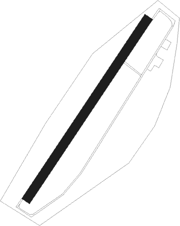
Runway info
| Runway 04 / 22 | ||
| length | 898m (2946ft) | |
| bearing | 49° / 229° | |
| width | 40m (131ft) | |
| surface | asphalt | |
| displ threshold | 200m (656ft) / 0m (0ft) | |
Nearby beacons
| code | identifier | dist | bearing | frequency |
|---|---|---|---|---|
| FRI | FRIBOURG VOR/DME | 21.1 | 290° | 110.85 |
| SIO | SION VOR/DME | 28.8 | 224° | 112.15 |
| WIL | WILLISAU VOR/DME | 35.1 | 22° | 116.90 |
| GRE | GRENCHEN VOR/DME | 35.8 | 335° | 115.45 |
| LPS | LES EPLATURES NDB | 46 | 298° | 403 |
| HOC | DME | 51.2 | 359° | 113.20 |
| SVC | COMAGNE (AOSTA) NDB | 52.1 | 178° | 418 |
| SCS | AOSTA VOR/DME | 54 | 201° | 109.25 |
| BS | BASLE-MULHOUSE NDB | 58.3 | 352° | 376 |
| MB | MONTBELIARD NDB | 61.7 | 320° | 330 |
| KLO | KLOTEN (ZURICH) VOR/DME | 61.8 | 46° | 114.85 |
| HR | HERICOURT NDB | 68.8 | 315° | 289 |
Disclaimer
The information on this website is not for real aviation. Use this data with the X-Plane flight simulator only! Data taken with kind consent from X-Plane 12 source code and data files. Content is subject to change without notice.