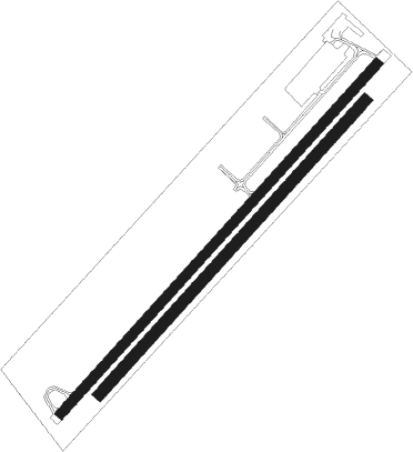
Yverdon-les-bains - Yverdon Les Bains
Airport details
| Country | Switzerland |
| State | Vaud |
| Region | LS |
| Airspace | Switzerland Ctr |
| Municipality | Yverdon-les-Bains |
| Elevation | 1419ft (433m) |
| Timezone | GMT +1 |
| Coordinates | 46.76194, 6.61333 |
| Magnetic var | |
| Type | land |
| Available since | X-Plane v10.40 |
| ICAO code | LSGY |
| IATA code | n/a |
| FAA code | n/a |
Communication
| Yverdon Les Bains ATIS | 132.600 |
| Yverdon Les Bains AFIS | 131.125 |
Nearby Points of Interest:
Maison Thorens - Yverdon
-Yverdon-les-Bains
-Public Library of Yverdon-les-Bains
-Villa d'Entremonts
-baie de Clendy
-Champvent
-Saint-Christophe manor
-Essertines-sur-Yverdon
-Reformed church of Grandson
-Château de Valeyres
-Saint-Marcel reformed church
-Grandson–Corcelettes Les Violes
-Pont du Moulinet
-Beffroi, Baulmes
-Abri de la Cure
-Église réformée Saint-Étienne de Montcherand
-reformed church Saint-Martin
-menhirs of Corcelles
-Canal d'Entreroches
-house of the lock keeper of the canal of Entreroches
-Sous-Colachoz, lakeside settlement
-Lignerolle
-Romainmôtier
-museum of the House of wheat and bread
-St-Antoine chapel, known as the Jacquemart
Nearby beacons
| code | identifier | dist | bearing | frequency |
|---|---|---|---|---|
| LAP | PRAZ DME | 9.7 | 247° | 110.65 |
| SPR | ST PREX VOR/DME | 18.8 | 209° | 113.90 |
| LPS | LES EPLATURES NDB | 20.6 | 29° | 403 |
| FRI | FRIBOURG VOR/DME | 25.1 | 89° | 110.85 |
| GLA | GLAND NDB | 26.1 | 226° | 375 |
| BSV | BESANCON NDB | 34.6 | 321° | 370 |
| GVA | GENEVA VOR/DME | 36.4 | 223° | 115.75 |
| GRE | GRENCHEN VOR/DME | 41.5 | 62° | 115.45 |
| SIO | SION VOR/DME | 43 | 129° | 112.15 |
| PAS | PASSEIRY VOR/DME | 43.9 | 226° | 116.60 |
| MB | MONTBELIARD NDB | 46.3 | 23° | 330 |
| HR | HERICOURT NDB | 48.2 | 8° | 289 |
| LUL | LUXEUIL VOR | 57.1 | 341° | 117.10 |
| AT | ANNECY NDB | 59.4 | 213° | 384 |
| BS | BASLE-MULHOUSE NDB | 61.9 | 48° | 376 |
| BLM | BASLE-MULHOUSE VOR/DME | 63.5 | 45° | 117.45 |
| CBY | CHAMBERY VOR/DME | 63.6 | 224° | 115.40 |
| BN | BASLE-MULHOUSE NDB | 64.5 | 44° | 353 |
Disclaimer
The information on this website is not for real aviation. Use this data with the X-Plane flight simulator only! Data taken with kind consent from X-Plane 12 source code and data files. Content is subject to change without notice.

