Zurich - Duebendorf
Airport details
| Country | Switzerland |
| State | Zurich |
| Region | LS |
| Airspace | Switzerland Ctr |
| Municipality | Dübendorf |
| Elevation | 1470ft (448m) |
| Timezone | GMT +1 |
| Coordinates | 47.39611, 8.63765 |
| Magnetic var | |
| Type | land |
| Available since | X-Plane v10.40 |
| ICAO code | LSMD |
| IATA code | n/a |
| FAA code | n/a |
Communication
| Duebendorf Tower | 128.475 |
| Duebendorf ARR | 134.925 |
Approach frequencies
| ILS-cat-I | RW29 | 111.15 | 18.00mi |
| 4.5° GS | RW29 | 111.15 | 18.00mi |
Nearby Points of Interest:
Dübendorf Air Base
-Schulschwimmanlage Stettbach
-Storen
-Doldertalhäuser
-MoneyMuseum
-Staatsarchiv des Kantons Zürich
-Federal Observatory
-Archive for the History of Medicine
-University Hospital Zurich
-Medizinhistorisches Museum der Universität Zürich
-Universität Zürich. Archäologische Sammlung
-ETH Library
-University of Zurich, main building
-Palaeontological Museum of the University of Zurich
-Archives of Contemporary History
-cloister of the former Barfüsser monastery
-Zentralbibliothek Zürich
-Beckenhof
-Baugeschichtliches Archiv Zürich
-Grimmen tower
-Villa Tobler
-Foundation E.G. Bührle Collection
-Freibad Allenmoos
-Swiss Social Archives
-Bilgeriturm
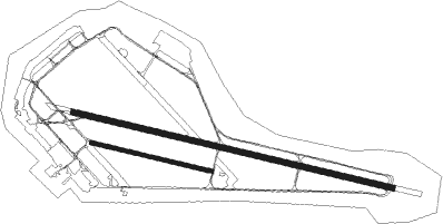
Runway info
Runway 11 / 29  | ||
| length | 2360m (7743ft) | |
| bearing | 102° / 282° | |
| width | 40m (131ft) | |
| surface | asphalt | |
| displ threshold | 0m (0ft) / 61m (200ft) | |
| Runway 11R / 29L | ||
| length | 888m (2913ft) | |
| bearing | 102° / 282° | |
| width | 30m (98ft) | |
| surface | grass | |
| blast zone | 0m (0ft) / 3m (10ft) | |
Nearby beacons
| code | identifier | dist | bearing | frequency |
|---|---|---|---|---|
| KLO | KLOTEN (ZURICH) VOR/DME | 5.2 | 304° | 114.85 |
| ZUE | ZURICH EAST VOR/DME | 13.8 | 43° | 110.05 |
| TRA | DME | 19.4 | 326° | 114.30 |
| WIL | WILLISAU VOR/DME | 32.5 | 253° | 116.90 |
| FHD | DME | 38.7 | 73° | 112.60 |
| HOC | DME | 39.7 | 274° | 113.20 |
| SUL | SULZ VOR | 59.1 | 0° | 116.10 |
| LHR | LAHR NDB | 66.1 | 319° | 337 |
| LRD | DME | 66.6 | 320° | 108.05 |
Departure and arrival routes
| Transition altitude | 7000ft |
| SID end points | distance | outbound heading | |
|---|---|---|---|
| RW11 | |||
| ZUE3Y | 14mi | 43° | |
| WIL3Y | 33mi | 253° | |
| RW29 | |||
| ZUE3X | 14mi | 43° | |
| WIL4X | 33mi | 253° | |
| STAR starting points | distance | inbound heading | |
|---|---|---|---|
| ALL | |||
| WIL1B, WIL4A | 32.5 | 73° | |
| ZUE4A | 13.8 | 223° | |
| NEGR1B | 37.5 | 248° | |
| KELI1B | 26.9 | 344° | |
Instrument approach procedures
| runway | airway (heading) | route (dist, bearing) |
|---|---|---|
| RW29-W | MD514 (40°) | MD514 6000ft MD505 (17mi, 97°) MD503 (5mi, 25°) 6000ft |
| RW29-W | MD516 (322°) | MD516 6000ft MD505 (8mi, 83°) MD503 (5mi, 25°) 6000ft |
| RW29-W | MD519 (258°) | MD519 6000ft MD504 (5mi, 131°) MD503 (5mi, 205°) 6000ft |
| RNAV | MD503 6000ft MD508 (5mi, 282°) 6000ft LSMD (11mi, 281°) 1523ft MD506 (turn) MD507 (3mi, 120°) 5000ft VIBAX (8mi, 96°) 6000ft VIBAX (turn) 6000ft | |
| RW29-X | MD519 (258°) | MD519 6000ft MD518 (4mi, 240°) 6000ft MD517 (4mi, 240°) 4000ft MD512 (turn) 4000ft MD510 (2mi, 267°) 3500ft |
| RNAV | MD510 3500ft LSMD (5mi, 280°) 1520ft MD506 (turn) 2450ft MD507 (3mi, 120°) 5000ft VIBAX (8mi, 96°) 6000ft VIBAX (turn) 6000ft | |
| RW29-Y | MD514 (40°) | MD514 6000ft MD513 (8mi, 89°) 6000ft MD511 (4mi, 41°) 4100ft MD510 (2mi, 300°) 3500ft |
| RW29-Y | MD516 (322°) | MD516 6000ft MD515 (7mi, 13°) 4500ft MD511 (2mi, 347°) 4100ft MD510 (2mi, 300°) 3500ft |
| RNAV | MD510 3500ft LSMD (5mi, 280°) 1520ft MD506 (turn) MD507 (3mi, 120°) 5000ft VIBAX (8mi, 96°) 6000ft VIBAX (turn) 6000ft | |
| RW29-Z | MD514 (40°) | MD514 6000ft MD505 (17mi, 97°) MD503 (5mi, 25°) 6000ft |
| RW29-Z | MD516 (322°) | MD516 6000ft MD505 (8mi, 83°) MD503 (5mi, 25°) 6000ft |
| RW29-Z | MD519 (258°) | MD519 6000ft MD504 (5mi, 131°) MD503 (5mi, 205°) 6000ft |
| RNAV | MD503 6000ft VIBAX (5mi, 282°) 6000ft LSMD (10mi, 281°) 1520ft MD506 (turn) MD507 (3mi, 120°) 5000ft VIBAX (8mi, 96°) 6000ft VIBAX (turn) 6000ft |
Holding patterns
| STAR name | hold at | type | turn | heading* | altitude | leg | speed limit |
|---|---|---|---|---|---|---|---|
| WIL4A | VIBAX | VHF | left | 106 (286)° | > 6000ft | 1.0min timed | 180 |
| ZUE4A | VIBAX | VHF | left | 106 (286)° | > 6000ft | 1.0min timed | 180 |
| *) magnetic outbound (inbound) holding course | |||||||
Disclaimer
The information on this website is not for real aviation. Use this data with the X-Plane flight simulator only! Data taken with kind consent from X-Plane 12 source code and data files. Content is subject to change without notice.