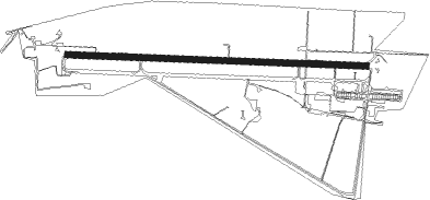
Meiringen
Airport details
| Country | Switzerland |
| State | Bern |
| Region | LS |
| Airspace | Switzerland Ctr |
| Municipality | Meiringen |
| Elevation | 1898ft (579m) |
| Timezone | GMT +1 |
| Coordinates | 46.74166, 8.10833 |
| Magnetic var | |
| Type | land |
| Available since | X-Plane v10.40 |
| ICAO code | LSMM |
| IATA code | n/a |
| FAA code | n/a |
Communication
| Meiringen Tower | 130.150 |
Nearby Points of Interest:
Brienz
-Reichenbachfall railway
-Schule für Holzbildhauerei
-Rudenz
-burial chapel
-Grosshaus Hofmatt
-Interlaken
-Interlaken Abbey
-Kloster St. Andreas, Sarnen
-Doppelhaus Grundacher, Sarnen
-cantonal library Obwalden
-Sarnen
-Wilderswil
-Former barracks Sarnen
-Stechelberg - Schilthorn cable car
-Pilatus railway
-Grabenbrücke
-Farbschachenbrücke
-Jungfrau-Aletsch protected area
-Furka Cogwheel Steam Railway
-Stanserhorn-Bahn
-Stans
-vineyard
-Langnau im Emmental
-Fadenbrücke
Nearby beacons
| code | identifier | dist | bearing | frequency |
|---|---|---|---|---|
| WIL | WILLISAU VOR/DME | 27.5 | 335° | 116.90 |
| FRI | FRIBOURG VOR/DME | 36.4 | 272° | 110.85 |
| GRE | GRENCHEN VOR/DME | 38.7 | 303° | 115.45 |
| SIO | SION VOR/DME | 46.3 | 237° | 112.15 |
| KLO | KLOTEN (ZURICH) VOR/DME | 46.5 | 31° | 114.85 |
| HOC | DME | 47.1 | 329° | 113.20 |
| BS | BASLE-MULHOUSE NDB | 55.4 | 326° | 376 |
| TRA | DME | 58.4 | 19° | 114.30 |
| ZUE | ZURICH EAST VOR/DME | 58.7 | 40° | 110.05 |
| BLM | BASLE-MULHOUSE VOR/DME | 59 | 326° | 117.45 |
| BN | BASLE-MULHOUSE NDB | 60.9 | 326° | 353 |
| SVC | COMAGNE (AOSTA) NDB | 62 | 202° | 418 |
| SCS | AOSTA VOR/DME | 67.8 | 218° | 109.25 |
Disclaimer
The information on this website is not for real aviation. Use this data with the X-Plane flight simulator only! Data taken with kind consent from X-Plane 12 source code and data files. Content is subject to change without notice.