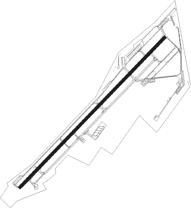
Payerne
Airport details
| Country | Switzerland |
| State | Fribourg |
| Region | LS |
| Airspace | Switzerland Ctr |
| Municipality | Estavayer |
| Elevation | 1462ft (446m) |
| Timezone | GMT +1 |
| Coordinates | 46.84250, 6.91361 |
| Magnetic var | |
| Type | land |
| Available since | X-Plane v10.40 |
| ICAO code | LSMP |
| IATA code | n/a |
| FAA code | n/a |
Communication
| Payerne Tower | 128.675 |
| Payerne ARR | 136.350 |
Approach frequencies
| ILS-cat-I | RW05 | 109.95 | 18.00mi |
| ILS-cat-I | RW23 | 109.3 | 18.00mi |
| 4.7° GS | RW05 | 109.95 | 18.00mi |
| 3.7° GS | RW23 | 109.3 | 18.00mi |
Nearby Points of Interest:
Église Notre-Dame de Payerne
-Payerne
-convent of the Dominican nuns of Estavayer
-Gletterens–Les Grèves
-Musée de l'Aviation Militaire de Payerne
-Granges-près-Marnand
-Villarzel
-Rectory (Avenches)
-Roman Museum in Avenches
-Aventicum
-Chabrey–Pointe de Montbec I
-Saint-Jean-L'Evangéliste
-ensemble mégalithique de Treytel-A Sugiez
-Treytorrens
-Combremont-le-Petit
-Domaine Cornaz et ses dépendances
-Temple de Colombier
-fountain of justice
-Sous-Colachoz, lakeside settlement
-La Baume du Four
-Romont
-Notre-Dame-de-la-Visitation chapel
-menhirs of Corcelles
-Library of the University of Neuchâtel
-Neuchâtel
Nearby beacons
| code | identifier | dist | bearing | frequency |
|---|---|---|---|---|
| FRI | FRIBOURG VOR/DME | 13.3 | 102° | 110.85 |
| LPS | LES EPLATURES NDB | 15.2 | 333° | 403 |
| LAP | PRAZ DME | 22.8 | 252° | 110.65 |
| GRE | GRENCHEN VOR/DME | 29 | 56° | 115.45 |
| SPR | ST PREX VOR/DME | 29.5 | 231° | 113.90 |
| GLA | GLAND NDB | 37.9 | 237° | 375 |
| BSV | BESANCON NDB | 38.6 | 301° | 370 |
| MB | MONTBELIARD NDB | 39.7 | 1° | 330 |
| SIO | SION VOR/DME | 40.7 | 149° | 112.15 |
| HR | HERICOURT NDB | 43.8 | 346° | 289 |
| WIL | WILLISAU VOR/DME | 45.3 | 71° | 116.90 |
| GVA | GENEVA VOR/DME | 47.8 | 233° | 115.75 |
| HOC | DME | 48.4 | 50° | 113.20 |
| BS | BASLE-MULHOUSE NDB | 51 | 40° | 376 |
| BLM | BASLE-MULHOUSE VOR/DME | 53.1 | 37° | 117.45 |
| BN | BASLE-MULHOUSE NDB | 54.3 | 35° | 353 |
| PAS | PASSEIRY VOR/DME | 55.5 | 233° | 116.60 |
| LUL | LUXEUIL VOR | 56.6 | 324° | 117.10 |
| LXI | LUXEUIL SAINT SAUVEUR TACAN | 60.8 | 329° | 108.20 |
| AT | ANNECY NDB | 69.5 | 222° | 384 |
Departure and arrival routes
| Transition altitude | 6000ft |
| SID end points | distance | outbound heading | |
|---|---|---|---|
| RW05 | |||
| BIRK3M | 22mi | 70° | |
| FRI2Q, FRI3M | 13mi | 102° | |
| RW23 | |||
| FRI2R, FRI3P | 13mi | 102° | |
| STAR starting points | distance | inbound heading | |
|---|---|---|---|
| RW05 | |||
| FRI3N | 13.3 | 282° | |
| RW23 | |||
| FRI1B, FRI4A | 13.3 | 282° | |
Instrument approach procedures
| runway | airway (heading) | route (dist, bearing) |
|---|---|---|
| RW05 | ETEKI (59°) | ETEKI 6000ft |
| RNAV | ETEKI 6000ft LSMP (10mi, 59°) 1518ft MP501 (5mi, 59°) FRI (11mi, 120°) 7000ft MP502 (6mi, 265°) 7000ft MP503 (8mi, 265°) ETEKI (6mi, 265°) | |
| RW23-Z | VALAD (239°) | VALAD 5000ft |
| RNAV | MP401 5000ft VALAD (3mi, 239°) 5000ft LSMP (10mi, 239°) 1507ft MP402 (4mi, 239°) FRI (16mi, 93°) 6000ft VALAD (12mi, 322°) |
Holding patterns
| STAR name | hold at | type | turn | heading* | altitude | leg | speed limit |
|---|---|---|---|---|---|---|---|
| FRI1B | VALAD | VHF | right | 47 (227)° | 5000ft - 6000ft | DME 3.5mi | 180 |
| FRI3N | ETEKI | VHF | right | 226 (46)° | 6000ft - 7000ft | 1.0min timed | 210 |
| FRI4A | VALAD | VHF | right | 47 (227)° | 5000ft - 6000ft | DME 3.5mi | 180 |
| *) magnetic outbound (inbound) holding course | |||||||
Disclaimer
The information on this website is not for real aviation. Use this data with the X-Plane flight simulator only! Data taken with kind consent from X-Plane 12 source code and data files. Content is subject to change without notice.