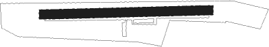
Amlikon
Airport details
| Country | Switzerland |
| State | Thurgau |
| Region | LS |
| Airspace | Switzerland Ctr |
| Municipality | Amlikon-Bissegg |
| Elevation | 1368ft (417m) |
| Timezone | GMT +1 |
| Coordinates | 47.57417, 9.04750 |
| Magnetic var | |
| Type | land |
| Available since | X-Plane v10.32 |
| ICAO code | LSPA |
| IATA code | n/a |
| FAA code | n/a |
Communication
| Amlikon AFIS | 120.125 |
Nearby Points of Interest:
Weinfelden
-Bürglen
-Kehlhof, Ermatingen
-Local Government building (Frauenfeld)
-Cantonal Library Thurgau
-Haus zur Gedult, Frauenfeld
-Redinghaus, Frauenfeld
-Haus zum Licht, Frauenfeld
-Rüpplinsche Kaplanei
-Frauenfeld
-Frauenfeld post office
-Turmhof
-Wil municipal archive
-Wil
-Kreuzlingen Abbey
-Hospital Bellevue
-Tröckneturm
-Schloss Windegg
-Altnau
-Sommeri
-Ehemaliges Benediktinerpriorat Wagenhausen
-Hemishofen rhine bridge
-Kesswil
-Kloster Magdenau
-Holzbrücke Anzenwil
Nearby beacons
| code | identifier | dist | bearing | frequency |
|---|---|---|---|---|
| ZUE | ZURICH EAST VOR/DME | 9.3 | 274° | 110.05 |
| FHD | DME | 19.3 | 78° | 112.60 |
| KLO | KLOTEN (ZURICH) VOR/DME | 21.5 | 257° | 114.85 |
| TRA | DME | 25.6 | 281° | 114.30 |
| SUL | SULZ VOR | 51.1 | 333° | 116.10 |
| LUP | LAUPHEIM NDB | 52 | 53° | 407 |
| WFJ | DME | 53.8 | 135° | 113.75 |
Disclaimer
The information on this website is not for real aviation. Use this data with the X-Plane flight simulator only! Data taken with kind consent from X-Plane 12 source code and data files. Content is subject to change without notice.