Langenthal - Flugplatz Langenthal
Airport details
| Country | Switzerland |
| State | Bern |
| Region | LS |
| Airspace | Switzerland Ctr |
| Municipality | Bleienbach |
| Elevation | 1575ft (480m) |
| Timezone | GMT +1 |
| Coordinates | 47.18278, 7.74139 |
| Magnetic var | |
| Type | land |
| Available since | X-Plane v10.40 |
| ICAO code | LSPL |
| IATA code | ZHW |
| FAA code | n/a |
Communication
| Flugplatz Langenthal AFIS | 118.975 |
Nearby Points of Interest:
Langenthal
-Aeschi SO–Burgäschisee Ost
-Wangen an der Aare
-Pfarrhaus, Wangen an der Aare
-local museum in the tower house
-covered wooden bridge over the Aare (1863)
-Steinbrugg Castle
-Reithalle
-Palais Besenval
-Siechenhaus (Burgdorf)
-solothurn youth hostel
-Solothurn
-Kapuzinerkloster Solothurn
-Zentralbibliothek Solothurn
-city archive Solothurn
-granary
-reformed church
-Staatsarchiv des Kantons Solothurn
-Burgdorf
-Saint Verena hermitage and sanctuary
-Helvetisches Goldmuseum
-catholic church
-Altishofen
-villa rustica of Zofingen
-St. Urban yard
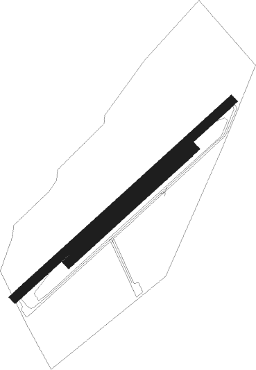
Runway info
Runway 05 / 23  | ||
| length | 584m (1916ft) | |
| bearing | 62° / 242° | |
| width | 18m (59ft) | |
| surface | asphalt | |
| displ threshold | 0m (0ft) / 110m (361ft) | |
| Runway 05R / 23L | ||
| length | 337m (1106ft) | |
| bearing | 62° / 242° | |
| width | 19m (61ft) | |
| surface | grass | |
Nearby beacons
| code | identifier | dist | bearing | frequency |
|---|---|---|---|---|
| WIL | WILLISAU VOR/DME | 6.7 | 92° | 116.90 |
| GRE | GRENCHEN VOR/DME | 13.1 | 270° | 115.45 |
| HOC | DME | 17.3 | 345° | 113.20 |
| BS | BASLE-MULHOUSE NDB | 25.2 | 333° | 376 |
| BLM | BASLE-MULHOUSE VOR/DME | 28.7 | 332° | 117.45 |
| BN | BASLE-MULHOUSE NDB | 30.6 | 331° | 353 |
| FRI | FRIBOURG VOR/DME | 32.2 | 232° | 110.85 |
| KLO | KLOTEN (ZURICH) VOR/DME | 36.6 | 71° | 114.85 |
| MB | MONTBELIARD NDB | 38.4 | 291° | 330 |
| LPS | LES EPLATURES NDB | 39.1 | 264° | 403 |
| TRA | DME | 41.5 | 54° | 114.30 |
| HO | COLMAR-HOUSSEN NDB | 59 | 338° | 380 |
| SIO | SION VOR/DME | 61 | 205° | 112.15 |
Disclaimer
The information on this website is not for real aviation. Use this data with the X-Plane flight simulator only! Data taken with kind consent from X-Plane 12 source code and data files. Content is subject to change without notice.