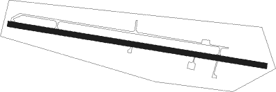
Quinto - Ambri
Airport details
| Country | Switzerland |
| State | Ticino |
| Region | LS |
| Airspace | Switzerland Ctr |
| Municipality | Quinto |
| Elevation | 3241ft (988m) |
| Timezone | GMT +1 |
| Coordinates | 46.51305, 8.68944 |
| Magnetic var | |
| Type | land |
| Available since | X-Plane v10.32 |
| ICAO code | LSPM |
| IATA code | n/a |
| FAA code | n/a |
Communication
| Ambri AFIS | 118.525 |
Nearby Points of Interest:
Gotthard Tunnel
-Prato
-Artilleriewerk Foppa Grande
-Church of Santa Maria Assunta, Chiggiogna
-Sornico
-Tennlenbrücke über die Furkareuss
-Chiesa di Sant'Ambrogio (Chironico)
-Göschenen
-Santa Maria Assunta
-Furka Cogwheel Steam Railway
-Chiesa parrocchiale di S. Bernardo e Via Crucis
-Sumvitg
-Stiftung Historisches Erbe der SBB
-parochial church of Saint Defendente
-Crestaulta
-Claro Abbey
-Schweinsberg Castle
-residential building Stüssihofstatt
-Locarno
-Cugnasco-Gerra oratory of Saints Anna and Cristoforo
-casa Serodine
-capuchin convent St. Karl
-Altdorf
-Cantonal Library Uri
-Bolle di Magadino
Nearby beacons
| code | identifier | dist | bearing | frequency |
|---|---|---|---|---|
| WIL | WILLISAU VOR/DME | 51.3 | 310° | 116.90 |
| MMP | MALPENSA (MILAN) VOR/DME | 52.4 | 177° | 113.35 |
| MMP | MALPENSA (MILAN) NDB | 52.5 | 177° | 425 |
| SRN | SARONNO NDB | 53.8 | 159° | 330 |
| CAM | CAMERI TACAN | 56.6 | 182° | 115 |
| KLO | KLOTEN (ZURICH) VOR/DME | 57 | 351° | 114.85 |
| MAL | MALPENSA (MILAN) NDB | 58.1 | 176° | 364 |
| SVC | COMAGNE (AOSTA) NDB | 61.3 | 232° | 418 |
| TZO | TREZZO VOR/DME | 66.6 | 139° | 117.25 |
| TZO | TREZZO NDB | 66.7 | 139° | 345 |
Disclaimer
The information on this website is not for real aviation. Use this data with the X-Plane flight simulator only! Data taken with kind consent from X-Plane 12 source code and data files. Content is subject to change without notice.
