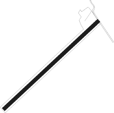
Olten
Airport details
| Country | Switzerland |
| State | Solothurn |
| Region | |
| Airspace | Switzerland Ctr |
| Municipality | Olten |
| Elevation | 1368ft (417m) |
| Timezone | GMT +1 |
| Coordinates | 47.33881, 7.87984 |
| Magnetic var | |
| Type | land |
| Available since | X-Plane v10.40 |
| ICAO code | LSPO |
| IATA code | n/a |
| FAA code | n/a |
Communication
Nearby Points of Interest:
Olten
-former hospital
-city and local archives of Zofingen
-Stadtbibliothek Zofingen
-city hall Zofingen
-St. Urban yard
-Zofingen
-Klösterli, Zofingen
-Pulverturm Zofingen
-Höhlenburg Riedfluh
-villa rustica of Zofingen
-Kapelle 14 Nothelfer
-covered wooden bridge over the Aare (1863)
-Kirche St. Martin
-thatched-roof house local museum
-Niedererlinsbach
-Anwil
-Dominikanerinnenkloster Aarau, Schweiz
-Aargau canton library (general collection)
-fountain of Justice
-christ catholic rectory (former helper's house)
-Grand Council building
-city hall
-Haus zum Erker
-Saxer house
Runway info
| Runway 05 / 23 | ||
| length | 1009m (3310ft) | |
| bearing | 62° / 242° | |
| width | 30m (98ft) | |
| surface | grass | |
Nearby beacons
| code | identifier | dist | bearing | frequency |
|---|---|---|---|---|
| WIL | WILLISAU VOR/DME | 9.6 | 171° | 116.90 |
| HOC | DME | 11.6 | 301° | 113.20 |
| BS | BASLE-MULHOUSE NDB | 20 | 305° | 376 |
| GRE | GRENCHEN VOR/DME | 21 | 251° | 115.45 |
| BLM | BASLE-MULHOUSE VOR/DME | 23.4 | 308° | 117.45 |
| BN | BASLE-MULHOUSE NDB | 25.3 | 309° | 353 |
| KLO | KLOTEN (ZURICH) VOR/DME | 27.9 | 80° | 114.85 |
| TRA | DME | 30.8 | 58° | 114.30 |
| MB | MONTBELIARD NDB | 40 | 280° | 330 |
| ZUE | ZURICH EAST VOR/DME | 41 | 75° | 110.05 |
| FRI | FRIBOURG VOR/DME | 43 | 229° | 110.85 |
| HO | COLMAR-HOUSSEN NDB | 52 | 327° | 380 |
Disclaimer
The information on this website is not for real aviation. Use this data with the X-Plane flight simulator only! Data taken with kind consent from X-Plane 12 source code and data files. Content is subject to change without notice.
