Montricher
Airport details
| Country | Switzerland |
| State | Vaud |
| Region | LS |
| Airspace | Switzerland Ctr |
| Municipality | Montricher |
| Elevation | 2178ft (664m) |
| Timezone | GMT +1 |
| Coordinates | 46.59028, 6.40056 |
| Magnetic var | |
| Type | land |
| Available since | X-Plane v10.40 |
| ICAO code | LSTR |
| IATA code | n/a |
| FAA code | n/a |
Communication
Nearby Points of Interest:
L'Isle
-sawmill Veyron les charbonnières
-Abri sous roche du Mollendruz
-Vullierens Castle
-former commandry
-Cromlech, megalithic complex of unknown date
-de Mestral château
-Cossonay
-manor house of Haute Roche
-Aubonne
-Centre d'archivage de la cinémathèque suisse
-Hôtel de ville d'Aubonne
-Maison d'Aspre
-Manoir de Bougy
-La Sarraz
-pillory
-St-Antoine chapel, known as the Jacquemart
-Morges
-Ancienne auberge de la Croix-Blanche, Morges
-Maison Linder
-d'En-Haut château
-Eclépens
-Église réformée Notre-Dame, Saint-Prex
-Romainmôtier
-Rochefort château
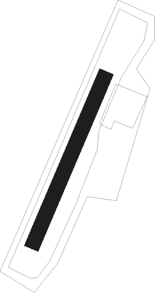
Runway info
| Runway 03 / 21 | ||
| length | 468m (1535ft) | |
| bearing | 37° / 217° | |
| width | 40m (131ft) | |
| surface | grass | |
Nearby beacons
| code | identifier | dist | bearing | frequency |
|---|---|---|---|---|
| LAP | PRAZ DME | 5.1 | 8° | 110.65 |
| SPR | ST PREX VOR/DME | 7.5 | 159° | 113.90 |
| GLA | GLAND NDB | 12.6 | 221° | 375 |
| GVA | GENEVA VOR/DME | 23 | 219° | 115.75 |
| PAS | PASSEIRY VOR/DME | 30.5 | 223° | 116.60 |
| LPS | LES EPLATURES NDB | 33.7 | 39° | 403 |
| FRI | FRIBOURG VOR/DME | 35.7 | 77° | 110.85 |
| BSV | BESANCON NDB | 41.4 | 344° | 370 |
| SIO | SION VOR/DME | 43.1 | 113° | 112.15 |
| AT | ANNECY NDB | 46.5 | 208° | 384 |
| CBY | CHAMBERY VOR/DME | 50.2 | 222° | 115.40 |
| MB | MONTBELIARD NDB | 58.9 | 30° | 330 |
| HR | HERICOURT NDB | 59.8 | 19° | 289 |
| CH | CHAMBERY NDB | 63.6 | 207° | 346 |
| SCS | AOSTA VOR/DME | 63.9 | 132° | 109.25 |
Disclaimer
The information on this website is not for real aviation. Use this data with the X-Plane flight simulator only! Data taken with kind consent from X-Plane 12 source code and data files. Content is subject to change without notice.