Wegenstetten - Fricktal-schupfart
Airport details
| Country | Switzerland |
| State | Aargau |
| Region | LS |
| Airspace | Switzerland Ctr |
| Municipality | Schupfart |
| Elevation | 1771ft (540m) |
| Timezone | GMT +1 |
| Coordinates | 47.50840, 7.94998 |
| Magnetic var | |
| Type | land |
| Available since | X-Plane v10.40 |
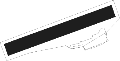
| ICAO code | LSZI |
| IATA code | n/a |
| FAA code | n/a |
Communication
Nearby Points of Interest:
christ catholic rectory
-christ catholic parish church
-christ catholic church of St. George
-rectory
-roman catholic church of St. George
-Anwil
-Sebastian chapel
-Maisprach
-Reformierte Kirche Wintersingen
-Kirche St. Martin
-Laufenburg
-catholic parish church
-Fahrgraben, Teil der spätrömischen Rheinbefestigung
-Bata Park
-Riburg «Bürkli», part of the late Roman Rhine fortification and early medieval fortification
-Rheinfelden
-former Gasthof zum goldenen Adler
-former Johanniterkommende
-Stadtbefestigung (Stadtmauer mit -graben, Obertorturm, Kupfer-/Storchennestturm, Messer-/Diebsturm)
-Flaig-House
-city hall
-schoolhouse Hugenfeld
-Zum Lustgarten house
-Niedererlinsbach
-Schlosskirche Beuggen

Nearby beacons
| code | identifier | dist | bearing | frequency |
|---|---|---|---|---|
| HOC | DME | 11.8 | 262° | 113.20 |
| BS | BASLE-MULHOUSE NDB | 17.3 | 280° | 376 |
| BLM | BASLE-MULHOUSE VOR/DME | 19.7 | 285° | 117.45 |
| WIL | WILLISAU VOR/DME | 19.9 | 188° | 116.90 |
| BN | BASLE-MULHOUSE NDB | 21.1 | 288° | 353 |
| TRA | DME | 22.5 | 70° | 114.30 |
| KLO | KLOTEN (ZURICH) VOR/DME | 24.3 | 95° | 114.85 |
| GRE | GRENCHEN VOR/DME | 29.1 | 239° | 115.45 |
| ZUE | ZURICH EAST VOR/DME | 35.5 | 84° | 110.05 |
| HO | COLMAR-HOUSSEN NDB | 44.3 | 317° | 380 |
| LHR | LAHR NDB | 50.7 | 351° | 337 |
| LRD | DME | 51.6 | 352° | 108.05 |
| FRI | FRIBOURG VOR/DME | 52.9 | 225° | 110.85 |
| SUL | SULZ VOR | 59.4 | 39° | 116.10 |
| STR | STRASBOURG ENTZHEIM VOR/DME | 61.7 | 339° | 115.60 |
Disclaimer
The information on this website is not for real aviation. Use this data with the X-Plane flight simulator only! Data taken with kind consent from X-Plane 12 source code and data files. Content is subject to change without notice.