Locarno
Airport details
| Country | Switzerland |
| State | Ticino |
| Region | LS |
| Airspace | Switzerland Ctr |
| Municipality | Locarno |
| Elevation | 648ft (198m) |
| Timezone | GMT +1 |
| Coordinates | 46.16295, 8.88178 |
| Magnetic var | |
| Type | land |
| Available since | X-Plane v10.40 |
| ICAO code | LSZL |
| IATA code | ZJI |
| FAA code | n/a |
Communication
| Locarno ATIS | 133.455 |
| Locarno Ground Control | 121.700 |
| Locarno Tower | 134.825 |
Nearby Points of Interest:
Bolle di Magadino
-Cugnasco-Gerra oratory of Saints Anna and Cristoforo
-Monte Ceneri transmitter
-Funkturm Monte Ceneri
-Locarno
-casa Serodine
-Fortini della Fame
-Archivio di Stato del Cantone Ticino
-Defensive Wall and Ramparts of Bellinzona
-Three Castles of Bellinzona
-Bellinzona
-Val Veddasca
-Tronzano Lago Maggiore
-Villa Negroni con parco
-Sant'Ambrogio vecchio di Cademario
-Claro Abbey
-S. Maurizio, Bioggio
-Maccagno
-parochial church of Saint Defendente
-Casa d'appartamenti Albairone, Massagno
-Swiss National Sound Archives
-Lugano
-Museo Cantonale d’Arte
-cantonal library Lugano (building)
-Museum of natural history
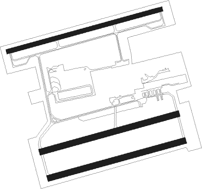
Runway info
Runway 08L / 26R  | ||
| length | 799m (2621ft) | |
| bearing | 82° / 262° | |
| width | 23m (75ft) | |
| surface | asphalt | |
| displ threshold | 130m (427ft) / 50m (164ft) | |
| Runway 08C / 26C | ||
| length | 708m (2323ft) | |
| bearing | 82° / 262° | |
| width | 30m (98ft) | |
| surface | grass | |
| Runway 08R / 26L | ||
| length | 699m (2293ft) | |
| bearing | 82° / 262° | |
| width | 30m (98ft) | |
| surface | grass | |
| displ threshold | 0m (0ft) / 100m (328ft) | |
Nearby beacons
| code | identifier | dist | bearing | frequency |
|---|---|---|---|---|
| SRN | SARONNO NDB | 31.5 | 165° | 330 |
| MMP | MALPENSA (MILAN) VOR/DME | 31.9 | 196° | 113.35 |
| MMP | MALPENSA (MILAN) NDB | 32 | 196° | 425 |
| CAM | CAMERI TACAN | 36.8 | 201° | 115 |
| MAL | MALPENSA (MILAN) NDB | 37.4 | 191° | 364 |
| CVA | DME | 41.9 | 75° | 112.05 |
| NOV | NOVARA (MILAN) NDB | 44.5 | 187° | 292 |
| TZO | TREZZO NDB | 44.7 | 134° | 345 |
| LIN | LINATE (MILAN) VOR/DME | 45.2 | 151° | 112.25 |
| BEG | BERGAMO VOR/DME | 45.5 | 121° | 114.95 |
| ORI | ORIO AL SERIO (BERGAMO) NDB | 50.8 | 118° | 376 |
| LNE | LINATE (MILAN) NDB | 52 | 154° | 386 |
| WFJ | DME | 55.2 | 54° | 113.75 |
| COD | CODOGNO NDB | 62.6 | 145° | 400 |
Disclaimer
The information on this website is not for real aviation. Use this data with the X-Plane flight simulator only! Data taken with kind consent from X-Plane 12 source code and data files. Content is subject to change without notice.