Hausen Am Albis / Hausen (dorf) - Hausen Am Albis
Airport details
| Country | Switzerland |
| State | Zurich |
| Region | LS |
| Airspace | Switzerland Ctr |
| Municipality | Hausen am Albis |
| Elevation | 1929ft (588m) |
| Timezone | GMT +1 |
| Coordinates | 47.23861, 8.51556 |
| Magnetic var | |
| Type | land |
| Available since | X-Plane v10.40 |
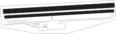
| ICAO code | LSZN |
| IATA code | n/a |
| FAA code | n/a |
Communication
Nearby Points of Interest:
Spinning mill on the Lorze (old building, administration building, Kosthäuser, boiler house, power station, water reservoir)
-Seepavillon Herner
-Horgen
-Sust local museum
-so-called Jenny Schloss with outbuilding
-Staatsarchiv Zug
-Bocken Estate
-Cham
-Zug
-Bibliothek Zug
-Zurlaubenhof, Zug
-Schweizerische Bauernhausforschung
-Meilen–Rorenhaab
-Winkel lakeside settlement
-Salesianum
-roman catholic parish church
-Zehntentrotte
-Meilen
-town hall (former parsonage)
-Wädenswil–Vorder Au
-catholic parish church
-chaplancy
-Jonen
-Meilen-Rorenhaab
-St. Joseph chapel

Nearby beacons
| code | identifier | dist | bearing | frequency |
|---|---|---|---|---|
| KLO | KLOTEN (ZURICH) VOR/DME | 13.1 | 8° | 114.85 |
| ZUE | ZURICH EAST VOR/DME | 24.5 | 41° | 110.05 |
| WIL | WILLISAU VOR/DME | 25.1 | 264° | 116.90 |
| TRA | DME | 27.2 | 350° | 114.30 |
| HOC | DME | 37.1 | 285° | 113.20 |
| BS | BASLE-MULHOUSE NDB | 44.7 | 289° | 376 |
| FHD | DME | 47.7 | 67° | 112.60 |
Disclaimer
The information on this website is not for real aviation. Use this data with the X-Plane flight simulator only! Data taken with kind consent from X-Plane 12 source code and data files. Content is subject to change without notice.