Lommis
Airport details
| Country | Switzerland |
| State | Thurgau |
| Region | LS |
| Airspace | Switzerland Ctr |
| Municipality | Lommis |
| Elevation | 1539ft (469m) |
| Timezone | GMT +1 |
| Coordinates | 47.52444, 9.00306 |
| Magnetic var | |
| Type | land |
| Available since | X-Plane v10.40 |
| ICAO code | LSZT |
| IATA code | n/a |
| FAA code | n/a |
Communication
| Lommis AFIS | 119.300 |
Nearby Points of Interest:
Wil municipal archive
-Wil
-Cantonal Library Thurgau
-Local Government building (Frauenfeld)
-Haus zum Licht, Frauenfeld
-Haus zur Gedult, Frauenfeld
-Redinghaus, Frauenfeld
-Rüpplinsche Kaplanei
-Frauenfeld
-Frauenfeld post office
-Tröckneturm
-Weinfelden
-Bürglen
-Turmhof
-Kehlhof, Ermatingen
-Kloster Magdenau
-Hohlandhaus
-Kreuzlingen Abbey
-Holzbrücke Anzenwil
-Hospital Bellevue
-Ehemaliges Benediktinerpriorat Wagenhausen
-Swiss Nail Factory
-Dampfbahn-Verein Zürcher Oberland
-Bütschwil
-Villa Rychenberg
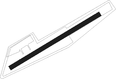
Runway info
| Runway 06 / 24 | ||
| length | 611m (2005ft) | |
| bearing | 71° / 251° | |
| width | 27m (90ft) | |
| surface | grass | |
Nearby beacons
| code | identifier | dist | bearing | frequency |
|---|---|---|---|---|
| ZUE | ZURICH EAST VOR/DME | 8.5 | 290° | 110.05 |
| KLO | KLOTEN (ZURICH) VOR/DME | 18.9 | 262° | 114.85 |
| FHD | DME | 22 | 74° | 112.60 |
| TRA | DME | 24.9 | 286° | 114.30 |
| WFJ | DME | 52.5 | 131° | 113.75 |
| SUL | SULZ VOR | 53.4 | 337° | 116.10 |
| LUP | LAUPHEIM NDB | 55.4 | 53° | 407 |
Disclaimer
The information on this website is not for real aviation. Use this data with the X-Plane flight simulator only! Data taken with kind consent from X-Plane 12 source code and data files. Content is subject to change without notice.