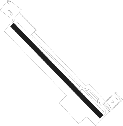
Thun
Airport details
| Country | Switzerland |
| State | Bern |
| Region | LS |
| Airspace | Switzerland Ctr |
| Municipality | Thun |
| Elevation | 1836ft (560m) |
| Timezone | GMT +1 |
| Coordinates | 46.75639, 7.60056 |
| Magnetic var | |
| Type | land |
| Available since | X-Plane v10.40 |
| ICAO code | LSZW |
| IATA code | n/a |
| FAA code | n/a |
Communication
| Thun AFIS | 123.250 |
Nearby Points of Interest:
Thun
-Blümlisalp
-Ortbühl country estate with economy buildings
-Kunstsammlung Hans & Marlis Suter
-Eichberg campagne
-vineyard
-Ursellen Estate
-Münsingen Psychiatric Center
-Campagne Rubigen
-Reformierte Kirche Zimmerwald
-reformed church Kleinhöchstetten
-Oberwil im Simmental
-Schwarzenburg short wave radio transmitter
-Lohn Castle
-Blumenhof
-Signau
-Schloss Hofgut (Gümligen)
-Villa Mettlen
-Interlaken
-Interlaken Abbey
-Schlössli Sinneringen
-Wilderswil
-Worblental
-Villa Morillon
-PTT Archive
Runway info
| Runway 14 / 32 | ||
| length | 800m (2625ft) | |
| bearing | 130° / 310° | |
| width | 30m (98ft) | |
| surface | grass | |
| displ threshold | 131m (430ft) / 101m (331ft) | |
Nearby beacons
| code | identifier | dist | bearing | frequency |
|---|---|---|---|---|
| FRI | FRIBOURG VOR/DME | 15.5 | 273° | 110.85 |
| GRE | GRENCHEN VOR/DME | 26.6 | 337° | 115.45 |
| WIL | WILLISAU VOR/DME | 28.2 | 36° | 116.90 |
| SIO | SION VOR/DME | 34.9 | 210° | 112.15 |
| LPS | LES EPLATURES NDB | 38.5 | 292° | 403 |
| HOC | DME | 42.7 | 5° | 113.20 |
| BS | BASLE-MULHOUSE NDB | 49.5 | 356° | 376 |
| BLM | BASLE-MULHOUSE VOR/DME | 52.7 | 353° | 117.45 |
| MB | MONTBELIARD NDB | 52.7 | 318° | 330 |
| BN | BASLE-MULHOUSE NDB | 54.5 | 352° | 353 |
| KLO | KLOTEN (ZURICH) VOR/DME | 57.1 | 53° | 114.85 |
| HR | HERICOURT NDB | 59.9 | 313° | 289 |
| TRA | DME | 65.6 | 42° | 114.30 |
Disclaimer
The information on this website is not for real aviation. Use this data with the X-Plane flight simulator only! Data taken with kind consent from X-Plane 12 source code and data files. Content is subject to change without notice.
