Ankara - Guvercinlik Ab
Airport details
| Country | Turkey |
| State | Ankara Province |
| Region | LT |
| Airspace | Ankara Ctr |
| Municipality | Etimesgut |
| Elevation | 2692ft (821m) |
| Timezone | GMT +2 |
| Coordinates | 39.93636, 32.74017 |
| Magnetic var | |
| Type | land |
| Available since | X-Plane v10.40 |
| ICAO code | LTAB |
| IATA code | n/a |
| FAA code | n/a |
Communication
| Guvercinlik AB Tower | 132.000 |
| Guvercinlik AB Tower | 129.000 |
Runway info
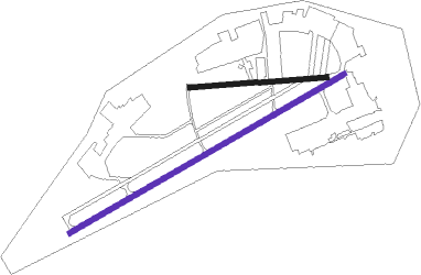
| Runway 06 / 24 | ||
| length | 2019m (6624ft) | |
| bearing | 70° / 250° | |
| width | 30m (98ft) | |
| surface | asphalt | |
| blast zone | 150m (492ft) / 0m (0ft) | |
Runway 09 / 27  | ||
| length | 870m (2854ft) | |
| bearing | 90° / 270° | |
| width | 30m (98ft) | |
| surface | asphalt | |
Nearby beacons
| code | identifier | dist | bearing | frequency |
|---|---|---|---|---|
| ETI | ANKARA-ETIMESGUT TACAN | 3.2 | 288° | 116.60 |
| ANK | ANKARA NDB | 4.1 | 79° | 356 |
| BAG | BAGLUM (ANKARA) VOR/DME | 8.6 | 28° | 113.10 |
| AN | ESENBOGA (ANKARA) NDB | 11.5 | 57° | 285 |
| ZIR | MURTED TACAN | 11.7 | 312° | 114.50 |
| GBI | GOLBASI NDB | 13.9 | 161° | 315 |
| NK | ESENBOGA (ANKARA) NDB | 14.9 | 54° | 305 |
| ESB | ESENBOGA (ANKARA) VOR/DME | 17.7 | 52° | 112.10 |
| BUK | CUBUK (ANKARA) NDB | 24.8 | 50° | 425 |
| HAY | HAYMANA NDB | 31.8 | 205° | 350 |
| BEY | BEYPAZARI NDB | 39.6 | 285° | 487 |
Disclaimer
The information on this website is not for real aviation. Use this data with the X-Plane flight simulator only! Data taken with kind consent from X-Plane 12 source code and data files. Content is subject to change without notice.