Ankara - Etimesgut
Airport details
| Country | Turkey |
| State | Ankara Province |
| Region | LT |
| Airspace | Ankara Ctr |
| Municipality | Etimesgut |
| Elevation | 2652ft (808m) |
| Timezone | GMT +3 |
| Coordinates | 39.94879, 32.68455 |
| Magnetic var | |
| Type | land |
| Available since | X-Plane v10.40 |
| ICAO code | LTAD |
| IATA code | ANK |
| FAA code | n/a |
Communication
| Etimesgut Tower | 122.100 |
| Etimesgut ESENBOGA Approach | 122.100 |
| Etimesgut ESENBOGA Approach | 119.100 |
| Etimesgut ESENBOGA Approach | 119.600 |
Approach frequencies
| ILS-cat-I | RW11 | 110.5 | 18.00mi |
| 3° GS | RW11 | 110.5 | 18.00mi |
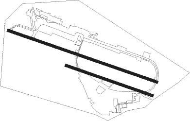
Runway info
Runway 11 / 29  | ||
| length | 2604m (8543ft) | |
| bearing | 109° / 289° | |
| width | 45m (148ft) | |
| surface | asphalt | |
| displ threshold | 150m (492ft) / 0m (0ft) | |
| blast zone | 0m (0ft) / 150m (492ft) | |
| Runway 11R / 29L | ||
| length | 1507m (4944ft) | |
| bearing | 109° / 289° | |
| width | 45m (148ft) | |
| surface | asphalt | |
Nearby beacons
| code | identifier | dist | bearing | frequency |
|---|---|---|---|---|
| ETI | ANKARA-ETIMESGUT TACAN | 0.6 | 311° | 116.60 |
| ANK | ANKARA NDB | 6.6 | 88° | 356 |
| BAG | BAGLUM (ANKARA) VOR/DME | 9.2 | 46° | 113.10 |
| ZIR | MURTED TACAN | 9.6 | 322° | 114.50 |
| AN | ESENBOGA (ANKARA) NDB | 13.2 | 66° | 285 |
| GBI | GOLBASI NDB | 15.5 | 150° | 315 |
| NK | ESENBOGA (ANKARA) NDB | 16.4 | 62° | 305 |
| ESB | ESENBOGA (ANKARA) VOR/DME | 19.1 | 59° | 112.10 |
| BUK | CUBUK (ANKARA) NDB | 26.1 | 55° | 425 |
| HAY | HAYMANA NDB | 31.8 | 199° | 350 |
| BEY | BEYPAZARI NDB | 36.9 | 286° | 487 |
Instrument approach procedures
| runway | airway (heading) | route (dist, bearing) |
|---|---|---|
| RW11 | AYHAN (109°) | AYHAN KUBOZ (4mi, 108°) 7600ft AD211 (5mi, 108°) 6200ft TURAF (3mi, 108°) 5200ft |
| RNAV | TURAF 5200ft AD212 (3mi, 109°) 4240ft MA111 (4mi, 109°) 2954ft AYHAN (19mi, 288°) 8000ft |
Disclaimer
The information on this website is not for real aviation. Use this data with the X-Plane flight simulator only! Data taken with kind consent from X-Plane 12 source code and data files. Content is subject to change without notice.