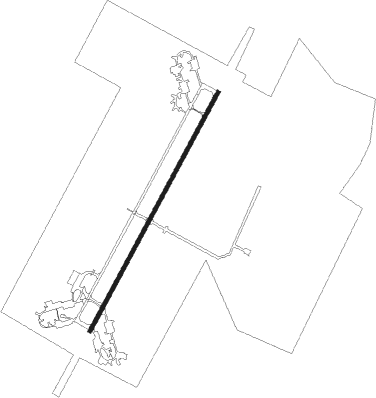
Ankara - Akinci Ab
Airport details
| Country | Turkey |
| State | Ankara Province |
| Region | LT |
| Airspace | Ankara Ctr |
| Municipality | Sincan |
| Elevation | 2767ft (843m) |
| Timezone | GMT +3 |
| Coordinates | 40.07975, 32.56231 |
| Magnetic var | |
| Type | land |
| Available since | X-Plane v10.30 |
| ICAO code | LTAE |
| IATA code | n/a |
| FAA code | n/a |
Communication
| Akinci AB Tower | 122.100 |
| Akinci AB ESENBOGA Approach | 119.100 |
| Akinci AB ESENBOGA Approach | 119.600 |
| Akinci AB ESENBOGA Approach | 122.100 |
Approach frequencies
| ILS-cat-I | RW03 | 109.55 | 18.00mi |
| 3° GS | RW03 | 109.55 | 18.00mi |
Nearby beacons
| code | identifier | dist | bearing | frequency |
|---|---|---|---|---|
| ZIR | MURTED TACAN | 0.7 | 65° | 114.50 |
| ETI | ANKARA-ETIMESGUT TACAN | 8.9 | 137° | 116.60 |
| BAG | BAGLUM (ANKARA) VOR/DME | 11.4 | 92° | 113.10 |
| ANK | ANKARA NDB | 14.4 | 115° | 356 |
| AN | ESENBOGA (ANKARA) NDB | 17 | 93° | 285 |
| NK | ESENBOGA (ANKARA) NDB | 19.1 | 86° | 305 |
| ESB | ESENBOGA (ANKARA) VOR/DME | 21 | 82° | 112.10 |
| GBI | GOLBASI NDB | 25 | 145° | 315 |
| BUK | CUBUK (ANKARA) NDB | 26.7 | 73° | 425 |
| BEY | BEYPAZARI NDB | 29.4 | 277° | 487 |
| HAY | HAYMANA NDB | 38.7 | 185° | 350 |
Instrument approach procedures
| runway | airway (heading) | route (dist, bearing) |
|---|---|---|
| RW03 | EKLOM (39°) | EKLOM 7000ft RAVSO (8mi, 40°) 5600ft |
| RNAV | RAVSO 5600ft AE141 (5mi, 40°) 4020ft LTAE (5mi, 38°) 2785ft AE016 (5mi, 42°) TUSAV (9mi, 40°) 7000ft TUSAV (turn) |
Disclaimer
The information on this website is not for real aviation. Use this data with the X-Plane flight simulator only! Data taken with kind consent from X-Plane 12 source code and data files. Content is subject to change without notice.
