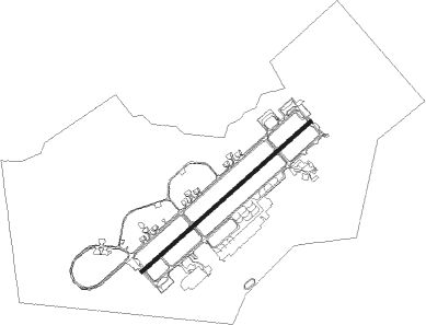
Adana - Incirlik Ab
Airport details
| Country | Turkey |
| State | Adana Province |
| Region | LT |
| Airspace | Ankara Ctr |
| Municipality | Sarıçam |
| Elevation | 234ft (71m) |
| Timezone | GMT +3 |
| Coordinates | 36.99889, 35.43306 |
| Magnetic var | |
| Type | land |
| Available since | X-Plane v10.40 |
| ICAO code | LTAG |
| IATA code | UAB |
| FAA code | n/a |
Communication
| Incirlik AB Ground Control | 123.025 |
| Incirlik AB Tower | 129.400 |
| Incirlik AB Tower | 122.100 |
| Incirlik AB Approach | 126.500 |
| Incirlik AB Departure | 128.000 |
Approach frequencies
| ILS-cat-I | RW05 | 109.3 | 18.00mi |
| ILS-cat-I | RW23 | 111.7 | 18.00mi |
| 3° GS | RW05 | 109.3 | 18.00mi |
| 3° GS | RW23 | 111.7 | 18.00mi |
Nearby beacons
| code | identifier | dist | bearing | frequency |
|---|---|---|---|---|
| DAN | INCIRLIK TACAN | 1.2 | 42° | 108.40 |
| ADN | ADANA NDB | 8.3 | 261° | 395 |
| ADA | ADANA VOR/DME | 11.2 | 255° | 112.70 |
| HTY | HATAY NDB | 56.2 | 127° | 336 |
Instrument approach procedures
| runway | airway (heading) | route (dist, bearing) |
|---|---|---|
| RW05 | JAKUP (60°) | JAKUP 3500ft |
| RNAV | JAKUP 3500ft GOMSE (6mi, 59°) 2300ft LTAG (7mi, 61°) 219ft (2967mi, 224°) 560ft TOSIE (2983mi, 44°) 5000ft TOSIE (turn) 9000ft | |
| RW23 | TOSIE (238°) | TOSIE 5000ft |
| RNAV | TOSIE 5000ft JAYBY (9mi, 239°) 2300ft HABIM (3mi, 239°) 1400ft WUNSO (1mi, 239°) 1000ft LTAG (3mi, 232°) 299ft (2967mi, 224°) 632ft JAKUP (2953mi, 44°) 3500ft JAKUP (turn) 9000ft |
Disclaimer
The information on this website is not for real aviation. Use this data with the X-Plane flight simulator only! Data taken with kind consent from X-Plane 12 source code and data files. Content is subject to change without notice.