Afyonkarahisar - Afyon
Airport details
| Country | Turkey |
| State | Afyonkarahisar Province |
| Region | LT |
| Airspace | Ankara Ctr |
| Municipality | Afyonkarahisar |
| Elevation | 3310ft (1009m) |
| Timezone | GMT +3 |
| Coordinates | 38.72583, 30.60306 |
| Magnetic var | |
| Type | land |
| Available since | X-Plane v10.30 |
| ICAO code | LTAH |
| IATA code | AFY |
| FAA code | n/a |
Communication
| Afyon Tower | 122.100 |
| Afyon Approach | 122.100 |
Approach frequencies
| ILS-cat-I | RW31R | 109.35 | 18.00mi |
| 3.3° GS | RW31R | 109.35 | 18.00mi |
Nearby Points of Interest:
Lake Karamık
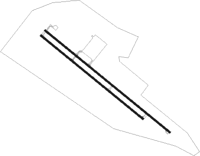
Runway info
Runway 13L / 31R  | ||
| length | 3666m (12028ft) | |
| bearing | 127° / 307° | |
| width | 45m (148ft) | |
| surface | concrete | |
| blast zone | 255m (837ft) / 143m (469ft) | |
| Runway 13R / 31L | ||
| length | 3001m (9846ft) | |
| bearing | 127° / 307° | |
| width | 46m (150ft) | |
| surface | concrete | |
| blast zone | 255m (837ft) / 255m (837ft) | |
Nearby beacons
| code | identifier | dist | bearing | frequency |
|---|---|---|---|---|
| KFK | AFYON NDB | 5.3 | 324° | 324 |
| KTH | ZAFER NDB | 31.6 | 309° | 336 |
| KUT | KUTAHYA TACAN | 50.4 | 320° | 113.40 |
| IPT | ISPARTA NDB | 54.4 | 196° | 349 |
| SYT | SIVRIHISAR (ESKISEHIR) TACAN | 56.2 | 47° | 109.20 |
| CRD | CARDAK NDB | 70.4 | 224° | 433 |
Departure and arrival routes
| Transition altitude | 10000ft |
| SID end points | distance | outbound heading | |
|---|---|---|---|
| RW13L | |||
| HALI1G | 91mi | 69° | |
| HISA1G | 57mi | 123° | |
| LEMD1G | 45mi | 176° | |
| RESL1G | 34mi | 228° | |
| KINI1G | 28mi | 271° | |
| KARG1G | 49mi | 322° | |
| RW31R | |||
| HALI1H | 91mi | 69° | |
| HISA1H | 57mi | 123° | |
| LEMD1H | 45mi | 176° | |
| RESL1H | 34mi | 228° | |
| KINI1H | 28mi | 271° | |
| KARG1H | 49mi | 322° | |
| STAR starting points | distance | inbound heading | |
|---|---|---|---|
| ALL | |||
| RESL1P | 34.4 | 48° | |
| TUME1P | 53.2 | 87° | |
| KINI1P | 28.2 | 91° | |
| KARG1P | 49.3 | 142° | |
| RW31R | |||
| RESL1R | 34.4 | 48° | |
| LEMD1R | 44.7 | 356° | |
Instrument approach procedures
| runway | airway (heading) | route (dist, bearing) |
|---|---|---|
| RW31R | APTEM (330°) | APTEM ETISU (6mi, 31°) 8400ft OLKON (6mi, 322°) 6500ft |
| RNAV | OLKON 6500ft AH311 (3mi, 307°) 5300ft AH312 (3mi, 307°) 4200ft AH313 (2mi, 307°) 3320ft (2872mi, 218°) 3740ft AH314 (2872mi, 38°) AH315 (4mi, 332°) INSIR (10mi, 286°) 9000ft INSIR (turn) 9000ft | |
| RWNVB | EMKER (116°) | EMKER LEBNO (6mi, 94°) 7400ft |
| RNAV | LEBNO 7400ft VEKUK (6mi, 123°) 5500ft AH131 (5mi, 136°) 4280ft (2872mi, 218°) 4280ft AH132 (2871mi, 38°) AH133 (4mi, 110°) DITET (6mi, 86°) 9000ft DITET (turn) 10000ft |
Disclaimer
The information on this website is not for real aviation. Use this data with the X-Plane flight simulator only! Data taken with kind consent from X-Plane 12 source code and data files. Content is subject to change without notice.