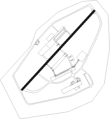
Malatya - Tulga
Airport details
| Country | Turkey |
| State | Malatya Province |
| Region | LT |
| Airspace | Ankara Ctr |
| Municipality | Yeşilyurt |
| Elevation | 3023ft (921m) |
| Timezone | GMT +3 |
| Coordinates | 38.34671, 38.24978 |
| Magnetic var | |
| Type | land |
| Available since | X-Plane v10.40 |
| ICAO code | LTAO |
| IATA code | MLX |
| FAA code | n/a |
Communication
Nearby beacons
| code | identifier | dist | bearing | frequency |
|---|---|---|---|---|
| ERH | MALATYA NDB | 9.5 | 310° | 421 |
| KHD | ADIYAMAN NDB | 38.6 | 162° | 381 |
| EZS | ELAZIG VOR/DME | 50.6 | 70° | 114.70 |
| GAP | GAP (SANLIURFA) NDB | 61.7 | 144° | 391 |
Departure and arrival routes
| Transition altitude | 10000ft |
| SID end points | distance | outbound heading | |
|---|---|---|---|
| RW04L | |||
| ASKE1R | 26mi | 97° | |
| UREB1R | 58mi | 292° | |
| RW04R | |||
| ASKE1S | 26mi | 97° | |
| UREB1S | 58mi | 292° | |
| RW22L | |||
| RASV2R | 52mi | 196° | |
| UREB2R | 58mi | 292° | |
| RW22R | |||
| RASV2R | 52mi | 196° | |
| UREB2R | 58mi | 292° | |
| STAR starting points | distance | inbound heading | |
|---|---|---|---|
| ALL | |||
| RASV1M, RASV1N | 52.2 | 16° | |
| SONS1N | 28.7 | 344° | |
| RW22R | |||
| RASV1P | 52.2 | 16° | |
| OKUD1G, OKUD1H, OKUD1K | 37.1 | 259° | |
| ASKE1G | 25.5 | 277° | |
| DIGI1G | 40.0 | 280° | |
| SONS1P | 28.7 | 344° | |
Instrument approach procedures
| runway | airway (heading) | route (dist, bearing) |
|---|---|---|
| RW22R | BEKVO (263°) | BEKVO INRAL (12mi, 295°) 7000ft |
| RW22R | ROLMU (234°) | ROLMU AO221 (5mi, 234°) 8500ft INRAL (5mi, 234°) 7000ft |
| RNAV | INRAL 7000ft ELRED (6mi, 234°) 5200ft LTAO (7mi, 233°) 3065ft ROLMU (23mi, 54°) 10000ft | |
| RWNVA | EMPAV (57°) | EMPAV ULPOK (10mi, 31°) 8000ft |
| RNAV | ULPOK 8000ft ASDEX (8mi, 68°) 5500ft AO111 (5mi, 79°) 4100ft AO112 (6mi, 79°) 5500ft AO113 (13mi, 43°) 10000ft AO113 (turn) 10000ft |
Disclaimer
The information on this website is not for real aviation. Use this data with the X-Plane flight simulator only! Data taken with kind consent from X-Plane 12 source code and data files. Content is subject to change without notice.
