Malatya - Erhac Ab
Airport details
| Country | Turkey |
| State | Malatya Province |
| Region | LT |
| Airspace | Ankara Ctr |
| Municipality | Akçadağ |
| Elevation | 2827ft (862m) |
| Timezone | GMT +3 |
| Coordinates | 38.43222, 38.08306 |
| Magnetic var | |
| Type | land |
| Available since | X-Plane v10.40 |
| ICAO code | LTAT |
| IATA code | MLX |
| FAA code | n/a |
Communication
| Erhac AB ATIS | 128.350 |
| Erhac AB Tower | 122.100 |
| Erhac AB Approach | 122.100 |
Approach frequencies
| ILS-cat-I | RW21L | 109.9 | 18.00mi |
| 3° GS | RW21L | 109.9 | 18.00mi |
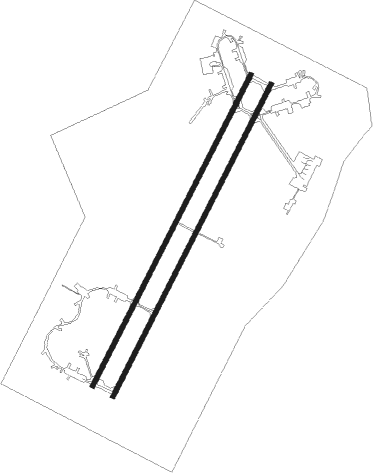
Runway info
Runway 03L / 21R  | ||
| length | 3353m (11001ft) | |
| bearing | 38° / 218° | |
| width | 45m (148ft) | |
| surface | concrete | |
| blast zone | 151m (495ft) / 150m (492ft) | |
| Runway 03R / 21L | ||
| length | 3358m (11017ft) | |
| bearing | 38° / 218° | |
| width | 45m (148ft) | |
| surface | asphalt | |
| blast zone | 255m (837ft) / 135m (443ft) | |
Nearby beacons
| code | identifier | dist | bearing | frequency |
|---|---|---|---|---|
| ERH | MALATYA NDB | 2.2 | 44° | 421 |
| KHD | ADIYAMAN NDB | 46 | 152° | 381 |
| GAP | GAP (SANLIURFA) NDB | 70.2 | 140° | 391 |
Departure and arrival routes
| Transition altitude | 10000ft |
| SID end points | distance | outbound heading | |
|---|---|---|---|
| RW03 (ALL) | |||
| OKUD1F | 44mi | 86° | |
| DIGI1F | 49mi | 103° | |
| SONS1F | 36mi | 151° | |
| RASV1F | 56mi | 185° | |
| UREB1F | 49mi | 291° | |
| RW21 (ALL) | |||
| OKUD1E | 44mi | 86° | |
| DIGI1E | 49mi | 103° | |
| SONS1E | 36mi | 151° | |
| RASV1E | 56mi | 185° | |
| UREB1E | 49mi | 291° | |
| STAR starting points | distance | inbound heading | |
|---|---|---|---|
| ALL | |||
| RASV1C, RASV1B, RASV1A, RASV1G, RASV1H, RASV1K, RASV1L, RASV1D | 56.2 | 5° | |
| UREB1D, UREB1C, UREB1B, UREB1A | 49.0 | 111° | |
| OKUD1D, OKUD1C, OKUD1B, OKUD1A | 43.9 | 266° | |
| DIGI1D, DIGI1C, DIGI1B, DIGI1A | 48.9 | 283° | |
| SONS1D, SONS1C, SONS1B, SONS1A | 36.1 | 331° | |
Holding patterns
| STAR name | hold at | type | turn | heading* | altitude | leg | speed limit |
|---|---|---|---|---|---|---|---|
| DIGI1A | ERH | NDB | right | 206 (26)° | > 7700ft | 1.0min timed | 230 |
| DIGI1B | ERH | NDB | right | 206 (26)° | > 7700ft | 1.0min timed | 230 |
| DIGI1C | ERH | NDB | right | 206 (26)° | > 7700ft | 1.0min timed | 230 |
| DIGI1D | ERH | NDB | right | 206 (26)° | > 7700ft | 1.0min timed | 230 |
| OKUD1A | ERH | NDB | right | 206 (26)° | > 7700ft | 1.0min timed | 230 |
| OKUD1B | ERH | NDB | right | 206 (26)° | > 7700ft | 1.0min timed | 230 |
| OKUD1C | ERH | NDB | right | 206 (26)° | > 7700ft | 1.0min timed | 230 |
| OKUD1D | ERH | NDB | right | 206 (26)° | > 7700ft | 1.0min timed | 230 |
| RASV1A | ERH | NDB | right | 206 (26)° | > 7700ft | 1.0min timed | 230 |
| RASV1B | ERH | NDB | right | 206 (26)° | > 7700ft | 1.0min timed | 230 |
| RASV1C | ERH | NDB | right | 206 (26)° | > 7700ft | 1.0min timed | 230 |
| RASV1D | ERH | NDB | right | 206 (26)° | > 7700ft | 1.0min timed | 230 |
| RASV1G | ERH | NDB | right | 206 (26)° | > 7700ft | 1.0min timed | 230 |
| RASV1H | ERH | NDB | right | 206 (26)° | > 7700ft | 1.0min timed | 230 |
| RASV1K | ERH | NDB | right | 206 (26)° | > 7700ft | 1.0min timed | 230 |
| RASV1L | ERH | NDB | right | 206 (26)° | > 7700ft | 1.0min timed | 230 |
| SONS1A | ERH | NDB | right | 206 (26)° | > 7700ft | 1.0min timed | 230 |
| SONS1B | ERH | NDB | right | 206 (26)° | > 7700ft | 1.0min timed | 230 |
| SONS1C | ERH | NDB | right | 206 (26)° | > 7700ft | 1.0min timed | 230 |
| SONS1D | ERH | NDB | right | 206 (26)° | > 7700ft | 1.0min timed | 230 |
| UREB1A | ERH | NDB | right | 206 (26)° | > 7700ft | 1.0min timed | 230 |
| UREB1B | ERH | NDB | right | 206 (26)° | > 7700ft | 1.0min timed | 230 |
| UREB1C | ERH | NDB | right | 206 (26)° | > 7700ft | 1.0min timed | 230 |
| UREB1D | ERH | NDB | right | 206 (26)° | > 7700ft | 1.0min timed | 230 |
| *) magnetic outbound (inbound) holding course | |||||||
Disclaimer
The information on this website is not for real aviation. Use this data with the X-Plane flight simulator only! Data taken with kind consent from X-Plane 12 source code and data files. Content is subject to change without notice.