Tokat
Airport details
| Country | Turkey |
| State | Tokat |
| Region | LT |
| Airspace | Ankara Ctr |
| Municipality | Tokat Merkez |
| Elevation | 1833ft (559m) |
| Timezone | GMT +3 |
| Coordinates | 40.31167, 36.37361 |
| Magnetic var | |
| Type | land |
| Available since | X-Plane v10.40 |
| ICAO code | LTAW |
| IATA code | TJK |
| FAA code | n/a |
Communication
| Tokat Tower | 118.700 |
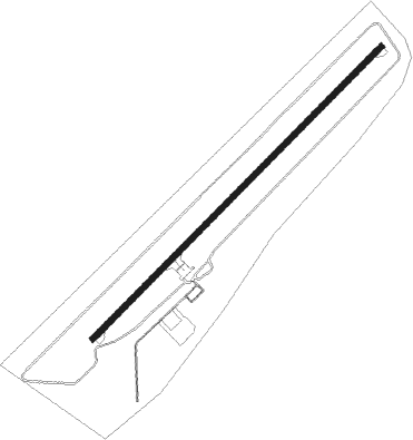
Runway info
| Runway 04 / 22 | ||
| length | 1924m (6312ft) | |
| bearing | 57° / 237° | |
| width | 30m (98ft) | |
| surface | asphalt | |
Nearby beacons
| code | identifier | dist | bearing | frequency |
|---|---|---|---|---|
| TKT | TOKAT NDB | 0.2 | 50° | 403 |
| SIV | SIVAS NDB | 39.4 | 135° | 310 |
| MNI | MERZIFON NDB | 49.7 | 301° | 440 |
| CRM | CARSAMBA (SAMSUN) NDB | 57.8 | 10° | 325 |
Departure and arrival routes
| Transition altitude | 10000ft |
| SID end points | distance | outbound heading | |
|---|---|---|---|
| RW04 | |||
| ENFO1C | 27mi | 193° | |
| STAR starting points | distance | inbound heading | |
|---|---|---|---|
| ALL | |||
| ENFO1A, ENFO1B | 26.6 | 13° | |
Holding patterns
| STAR name | hold at | type | turn | heading* | altitude | leg | speed limit |
|---|---|---|---|---|---|---|---|
| ENFO1A | TKT | NDB | right | 74 (254)° | > 7500ft | 1.0min timed | ICAO rules |
| ENFO1B | TKT | NDB | right | 74 (254)° | > 7500ft | 1.0min timed | ICAO rules |
| *) magnetic outbound (inbound) holding course | |||||||
Disclaimer
The information on this website is not for real aviation. Use this data with the X-Plane flight simulator only! Data taken with kind consent from X-Plane 12 source code and data files. Content is subject to change without notice.