Istanbul - Istanbul Ataturk
Airport details
| Country | Turkey |
| State | İstanbul Province |
| Region | LT |
| Airspace | Istanbul Ctr |
| Municipality | Bakırköy |
| Elevation | 163ft (50m) |
| Timezone | GMT +3 |
| Coordinates | 40.97611, 28.81417 |
| Magnetic var | |
| Type | land |
| Available since | X-Plane v10.40 |
| ICAO code | LTBA |
| IATA code | IST |
| FAA code | n/a |
Communication
| Istanbul Ataturk ATIS | 128.200 |
| Istanbul Ataturk YESILKOY DELIVERY | 121.700 |
| Istanbul Ataturk YESILKOY Ground Control NORTH | 121.600 |
| Istanbul Ataturk YESILKOY Ground Control SOUTH | 121.800 |
| Istanbul Ataturk YESILKOY Tower Approach | 118.100 |
| Istanbul Ataturk YESILKOY Tower Departure | 118.375 |
Approach frequencies
| ILS-cat-III | RW05 | 110.3 | 18.00mi |
| ILS-cat-I | RW23 | 111.9 | 18.00mi |
| 3.2° GS | RW23 | 111.9 | 18.00mi |
| 3° GS | RW05 | 110.3 | 18.00mi |
Nearby Points of Interest:
Runic inscriptions in Hagia Sophia
-Historic Areas of Istanbul
-Princes' Islands
-Bosporus
Runway info
Runway 17R / 35L  | ||
| length | 3006m (9862ft) | |
| bearing | 178° / 358° | |
| width | 45m (148ft) | |
| surface | concrete | |
| blast zone | 59m (194ft) / 0m (0ft) | |
| Runway 17L / 35R | ||
| length | 3007m (9865ft) | |
| bearing | 178° / 358° | |
| width | 45m (148ft) | |
| surface | concrete | |
| blast zone | 60m (197ft) / 60m (197ft) | |
| Runway 05 / 23 | ||
| length | 2582m (8471ft) | |
| bearing | 65° / 245° | |
| width | 60m (197ft) | |
| surface | asphalt | |
| displ threshold | 136m (446ft) / 0m (0ft) | |
| blast zone | 77m (253ft) / 63m (207ft) | |
Airport layout
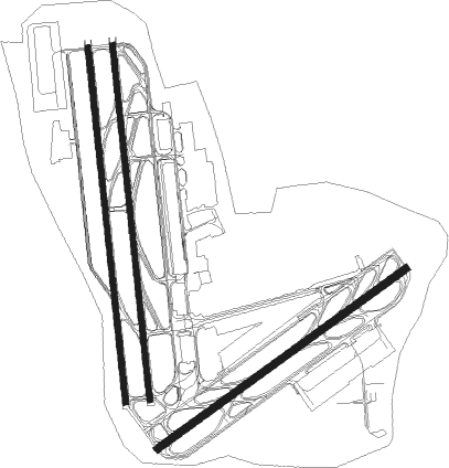
Taxiway locations
|
Parking locations
Nearby beacons
| code | identifier | dist | bearing | frequency |
|---|---|---|---|---|
| IST | ISTANBUL VORTAC | 0.8 | 193° | 112.50 |
| ST | ATATURK (ISTANBUL) NDB | 0.9 | 218° | 340 |
| CEK | CEKMECE NDB | 13 | 276° | 328 |
| BKZ | BEYKOZ VOR/DME | 17.4 | 65° | 117.30 |
| UHN | UHN VOR/DME | 20.2 | 350° | 109.85 |
| UHM | UHM VOR/DME | 20.4 | 345° | 108.25 |
| UHL | UHL VOR/DME | 20.7 | 342° | 110 |
| SAB | SABIHA NDB | 23.8 | 98° | 347 |
| SBH | SABIHA (ISTANBUL) VOR/DME | 23.8 | 98° | 108.80 |
| YAA | YALOVA VOR/DME | 35 | 142° | 117.70 |
| CRL | CORLU VOR/DME | 41.1 | 281° | 114.80 |
| CLU | CORLU TACAN | 41.4 | 281° | 115.90 |
| CRL | CORLU NDB | 41.9 | 280° | 426 |
| BDM | BANDIRMA TACAN | 54.8 | 232° | 111 |
| YEN | YENISEHIR TACAN | 55 | 134° | 113.20 |
| BRY | YENISEHIR NDB | 55.6 | 132° | 352 |
Departure and arrival routes
| Transition altitude | 12000ft |
| Transition level | 13000ft |
| SID end points | distance | outbound heading | |
|---|---|---|---|
| RW05 | |||
| MAKO3A | 73mi | 15° | |
| ERTA2M, ERTA2N | 33mi | 34° | |
| BKZ1N | 17mi | 65° | |
| NUGB3A | 92mi | 72° | |
| ASMA3N, ASMA3A | 89mi | 100° | |
| ROXU3N, ROXU3A | 77mi | 140° | |
| YAA2N | 35mi | 142° | |
| IVGU3N, IVGU3A | 61mi | 252° | |
| BARP3N, BARP3A | 83mi | 268° | |
| VADE3A | 97mi | 304° | |
| TUDB3A | 76mi | 314° | |
| IBLA3A | 71mi | 321° | |
| RW23 | |||
| MAKO3B, MAKO3P | 73mi | 15° | |
| ERTA3G | 33mi | 34° | |
| BKZ1P | 17mi | 65° | |
| NUGB3B, NUGB3P | 92mi | 72° | |
| ASMA3P, ASMA3B | 89mi | 100° | |
| ROXU3B, ROXU3P | 77mi | 140° | |
| YAA3G | 35mi | 142° | |
| IVGU3B, IVGU3P | 61mi | 252° | |
| BARP3B, BARP3P | 83mi | 268° | |
| EKI3G | 63mi | 269° | |
| CRL3G | 41mi | 281° | |
| VADE3B, VADE3P | 97mi | 304° | |
| FENE3H | 28mi | 304° | |
| TUDB3B, TUDB3P | 76mi | 314° | |
| IBLA3P, IBLA3B | 71mi | 321° | |
| STAR starting points | distance | inbound heading | |
|---|---|---|---|
| RW05 | |||
| KONE2Q | 99.1 | 53° | |
| DRAM2Q | 99.9 | 92° | |
| ATVE2Q | 88.9 | 105° | |
| GINL2Q | 53.7 | 177° | |
| AKCA2Q, AKCA2S | 90.5 | 257° | |
| VEVU2S, VEVU2Q | 115.3 | 284° | |
| SISP2Q | 79.9 | 315° | |
| RW23 | |||
| KONE2R | 99.1 | 53° | |
| DRAM2R | 99.9 | 92° | |
| ATVE2R | 88.9 | 105° | |
| GINL2R | 53.7 | 177° | |
| AKCA2R | 90.5 | 257° | |
| VEVU2R | 115.3 | 284° | |
| SISP2R | 79.9 | 315° | |
Holding patterns
| STAR name | hold at | type | turn | heading* | altitude | leg | speed limit |
|---|---|---|---|---|---|---|---|
| AKCA2Q | BA444 | VHF | left | 85 (265)° | > 18000ft | 1.0min timed | ICAO rules |
| AKCA2Q | WISNE | VHF | right | 233 (53)° | 3000ft - 4000ft | 1.0min timed | ICAO rules |
| AKCA2R | IPSUD | VHF | left | 53 (233)° | > 4500ft | 1.0min timed | ICAO rules |
| AKCA2S | WISNE | VHF | right | 233 (53)° | 3000ft - 4000ft | 1.0min timed | ICAO rules |
| ATVE2Q | BA358 | VHF | right | 265 (85)° | > 7000ft | 1.0min timed | ICAO rules |
| ATVE2Q | WISNE | VHF | right | 233 (53)° | 3000ft - 4000ft | 1.0min timed | ICAO rules |
| ATVE2R | IPSUD | VHF | left | 53 (233)° | > 4500ft | 1.0min timed | ICAO rules |
| ATVE2R | IRDED | VHF | right | 253 (73)° | > 7000ft | 1.0min timed | ICAO rules |
| DRAM2Q | BA358 | VHF | right | 265 (85)° | > 7000ft | 1.0min timed | ICAO rules |
| DRAM2Q | WISNE | VHF | right | 233 (53)° | 3000ft - 4000ft | 1.0min timed | ICAO rules |
| DRAM2R | IPSUD | VHF | left | 53 (233)° | > 4500ft | 1.0min timed | ICAO rules |
| DRAM2R | IRDED | VHF | right | 253 (73)° | > 7000ft | 1.0min timed | ICAO rules |
| GINL2Q | WISNE | VHF | right | 233 (53)° | 3000ft - 4000ft | 1.0min timed | ICAO rules |
| GINL2R | IPSUD | VHF | left | 53 (233)° | > 4500ft | 1.0min timed | ICAO rules |
| KONE2Q | BA358 | VHF | right | 265 (85)° | > 7000ft | 1.0min timed | ICAO rules |
| KONE2Q | WISNE | VHF | right | 233 (53)° | 3000ft - 4000ft | 1.0min timed | ICAO rules |
| KONE2R | IPSUD | VHF | left | 53 (233)° | > 4500ft | 1.0min timed | ICAO rules |
| KONE2R | IRDED | VHF | right | 253 (73)° | > 7000ft | 1.0min timed | ICAO rules |
| SISP2Q | SPATZ | VHF | right | 150 (330)° | > 10000ft | 1.0min timed | ICAO rules |
| SISP2Q | WISNE | VHF | right | 233 (53)° | 3000ft - 4000ft | 1.0min timed | ICAO rules |
| SISP2R | IPSUD | VHF | left | 53 (233)° | > 4500ft | 1.0min timed | ICAO rules |
| VEVU2Q | BA444 | VHF | left | 85 (265)° | > 18000ft | 1.0min timed | ICAO rules |
| VEVU2Q | WISNE | VHF | right | 233 (53)° | 3000ft - 4000ft | 1.0min timed | ICAO rules |
| VEVU2R | IPSUD | VHF | left | 53 (233)° | > 4500ft | 1.0min timed | ICAO rules |
| VEVU2S | WISNE | VHF | right | 233 (53)° | 3000ft - 4000ft | 1.0min timed | ICAO rules |
| *) magnetic outbound (inbound) holding course | |||||||
Disclaimer
The information on this website is not for real aviation. Use this data with the X-Plane flight simulator only! Data taken with kind consent from X-Plane 12 source code and data files. Content is subject to change without notice.