Uşak - Usak
Airport details
| Country | Turkey |
| State | Uşak Province |
| Region | LT |
| Airspace | Istanbul Ctr |
| Municipality | Uşak |
| Elevation | 2895ft (882m) |
| Timezone | GMT +3 |
| Coordinates | 38.68139, 29.47167 |
| Magnetic var | |
| Type | land |
| Available since | X-Plane v10.40 |
| ICAO code | LTBO |
| IATA code | USQ |
| FAA code | n/a |
Communication
| Usak Tower | 121.700 |
| Usak Tower | 121.425 |
| Usak MENDERES Approach | 132.050 |
Runway info
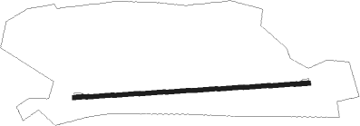
| Runway 09 / 27 | ||
| length | 2550m (8366ft) | |
| bearing | 91° / 271° | |
| width | 45m (148ft) | |
| surface | concrete | |
| blast zone | 65m (213ft) / 60m (197ft) | |
Nearby beacons
| code | identifier | dist | bearing | frequency |
|---|---|---|---|---|
| USK | USAK NDB | 0.2 | 58° | 414 |
| KTH | ZAFER NDB | 40.1 | 57° | 336 |
| DEN | KULA VOR/DME | 41.2 | 263° | 112.05 |
| KUT | KUTAHYA TACAN | 51.5 | 36° | 113.40 |
| CRD | CARDAK NDB | 54.6 | 165° | 433 |
| IPT | ISPARTA NDB | 65 | 134° | 349 |
Departure and arrival routes
| Transition altitude | 10000ft |
| SID end points | distance | outbound heading | |
|---|---|---|---|
| RW09 | |||
| KINI1A, KINI1B | 25mi | 84° | |
| NESE1A | 17mi | 262° | |
| RW27 | |||
| KINI1C | 25mi | 84° | |
| NESE1B | 17mi | 262° | |
| STAR starting points | distance | inbound heading | |
|---|---|---|---|
| ALL | |||
| NESE1D | 16.7 | 82° | |
| KINI1D | 24.9 | 264° | |
Disclaimer
The information on this website is not for real aviation. Use this data with the X-Plane flight simulator only! Data taken with kind consent from X-Plane 12 source code and data files. Content is subject to change without notice.