Bursa - Yenisehir Ab
Airport details
| Country | Turkey |
| State | Bursa Province |
| Region | LT |
| Airspace | Istanbul Ctr |
| Municipality | Yenişehir |
| Elevation | 762ft (232m) |
| Timezone | GMT +3 |
| Coordinates | 40.25309, 29.56544 |
| Magnetic var | |
| Type | land |
| Available since | X-Plane v10.40 |
| ICAO code | LTBR |
| IATA code | YEI |
| FAA code | n/a |
Communication
| Yenisehir AB Tower | 122.100 |
| Yenisehir AB Tower | 124.200 |
| Yenisehir AB Approach | 122.100 |
| Yenisehir AB Approach | 124.200 |
Approach frequencies
| ILS-cat-I | RW25R | 108.5 | 18.00mi |
| 3° GS | RW25R | 108.5 | 18.00mi |
Nearby Points of Interest:
Bursa and Cumalıkızık: the Birth of the Ottoman Empire
-Complex of Mehmed I
-Hüdavendigar Complex
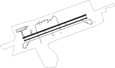
Runway info
Runway 07L / 25R  | ||
| length | 2985m (9793ft) | |
| bearing | 78° / 258° | |
| width | 45m (148ft) | |
| surface | concrete | |
| blast zone | 255m (837ft) / 255m (837ft) | |
| Runway 07R / 25L | ||
| length | 2987m (9800ft) | |
| bearing | 78° / 258° | |
| width | 30m (98ft) | |
| surface | concrete | |
| blast zone | 177m (581ft) / 182m (597ft) | |
Nearby beacons
| code | identifier | dist | bearing | frequency |
|---|---|---|---|---|
| YEN | YENISEHIR TACAN | 0.2 | 329° | 113.20 |
| BRY | YENISEHIR NDB | 1.4 | 72° | 352 |
| YAA | YALOVA VOR/DME | 21.1 | 302° | 117.70 |
| ARF | CENGIZ TOPEL TACAN | 36.9 | 46° | 113.90 |
| CTP | CENGIZ TOPEL (KOCAELI) NDB | 37.1 | 46° | 307 |
| ARF | CENGIZ TOPEL NDB | 37.3 | 47° | 383 |
| SAB | SABIHA NDB | 40.7 | 340° | 347 |
| SBH | SABIHA (ISTANBUL) VOR/DME | 40.7 | 340° | 108.80 |
| ESR | ESKISEHIR NDB | 50.9 | 115° | 372 |
| KUT | KUTAHYA TACAN | 53.5 | 151° | 113.40 |
| IST | ISTANBUL VORTAC | 54.7 | 313° | 112.50 |
| ST | ATATURK (ISTANBUL) NDB | 54.9 | 313° | 340 |
| BKZ | BEYKOZ VOR/DME | 55.8 | 334° | 117.30 |
Departure and arrival routes
| Transition altitude | 10000ft |
| SID end points | distance | outbound heading | |
|---|---|---|---|
| RW07L | |||
| EKME1B | 29mi | 79° | |
| SULT1A, SULT1B | 15mi | 140° | |
| YAA1B | 21mi | 302° | |
| RW25R | |||
| EKME1D | 29mi | 79° | |
| SULT1C, SULT1D | 15mi | 140° | |
| YAA1D | 21mi | 302° | |
| STAR starting points | distance | inbound heading | |
|---|---|---|---|
| ALL | |||
| YAA1E | 21.1 | 122° | |
| BKZ1E | 55.8 | 154° | |
| EKME1E | 29.2 | 259° | |
| SULT1E | 14.8 | 320° | |
| RW25R | |||
| YAA1H | 21.1 | 122° | |
| BKZ1H | 55.8 | 154° | |
| EKME1H | 29.2 | 259° | |
| SULT1H | 14.8 | 320° | |
Holding patterns
| STAR name | hold at | type | turn | heading* | altitude | leg | speed limit |
|---|---|---|---|---|---|---|---|
| BKZ1E | BRY | NDB | left | 248 (68)° | > 9000ft | 1.0min timed | 230 |
| BKZ1H | KESEV | VHF | left | 70 (250)° | > 4700ft | 1.0min timed | ICAO rules |
| EKME1H | KESEV | VHF | left | 70 (250)° | > 4700ft | 1.0min timed | ICAO rules |
| SULT1H | KESEV | VHF | left | 70 (250)° | > 4700ft | 1.0min timed | ICAO rules |
| YAA1H | KESEV | VHF | left | 70 (250)° | > 4700ft | 1.0min timed | ICAO rules |
| *) magnetic outbound (inbound) holding course | |||||||
Disclaimer
The information on this website is not for real aviation. Use this data with the X-Plane flight simulator only! Data taken with kind consent from X-Plane 12 source code and data files. Content is subject to change without notice.