Akhisar Ab
Airport details
| Country | Turkey |
| State | Manisa Province |
| Region | LT |
| Airspace | Istanbul Ctr |
| Municipality | Akhisar |
| Elevation | 263ft (80m) |
| Timezone | GMT +3 |
| Coordinates | 38.80944, 27.83444 |
| Magnetic var | |
| Type | land |
| Available since | X-Plane v10.30 |
| ICAO code | LTBT |
| IATA code | n/a |
| FAA code | n/a |
Communication
| Akhisar AB Akhisar Tower | 122.100 |
| Akhisar AB Menderes Approach | 120.100 |
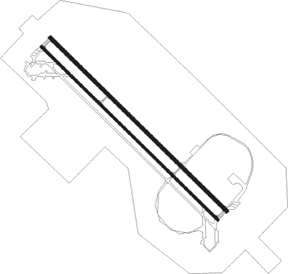
Runway info
Runway 14L / 32R  | ||
| length | 2992m (9816ft) | |
| bearing | 132° / 312° | |
| width | 45m (148ft) | |
| surface | concrete | |
| blast zone | 155m (509ft) / 149m (489ft) | |
| Runway 14R / 32L | ||
| length | 2992m (9816ft) | |
| bearing | 132° / 312° | |
| width | 30m (98ft) | |
| surface | concrete | |
| blast zone | 150m (492ft) / 150m (492ft) | |
Nearby beacons
| code | identifier | dist | bearing | frequency |
|---|---|---|---|---|
| AKI | AKHISAR TACAN | 0.6 | 324° | 110.20 |
| DEN | KULA VOR/DME | 38.5 | 107° | 112.05 |
| CIG | CIGLI (IZMIR) NDB | 41.9 | 251° | 363 |
| CIG | CIGLI (IZMIR) TACAN | 43 | 249° | 113.60 |
| KLC | KAKLIC TACAN | 43.6 | 251° | 114.15 |
| MEN | MENDERES (IZMIR) VOR/DME | 44.2 | 233° | 117.90 |
| EN | ADNAN MENDERES (IZMIR) NDB | 45.2 | 231° | 315 |
| ME | ADNAN MENDERES (IZMIR) NDB | 47.7 | 227° | 405 |
| IMR | IZMIR VOR/DME | 48.8 | 239° | 113.70 |
| BRI | BALIKESIR NDB | 49.5 | 7° | 470 |
| SEL | SELCUK-EFES NDB | 56.8 | 210° | 424 |
| EDR | EDREMIT NDB | 58.9 | 312° | 368 |
| CLD | CILDIR (AYDIN) NDB | 59.6 | 177° | 480 |
| CLD | CILDIR (AYDIN) VOR/DME | 59.8 | 176° | 113.85 |
Disclaimer
The information on this website is not for real aviation. Use this data with the X-Plane flight simulator only! Data taken with kind consent from X-Plane 12 source code and data files. Content is subject to change without notice.