Istanbul - Hezarfen
Airport details
| Country | Turkey |
| State | İstanbul Province |
| Region | LT |
| Airspace | Istanbul Ctr |
| Municipality | Çatalca |
| Elevation | 62ft (19m) |
| Timezone | GMT +3 |
| Coordinates | 41.10417, 28.55000 |
| Magnetic var | |
| Type | land |
| Available since | X-Plane v10.40 |
| ICAO code | LTBW |
| IATA code | n/a |
| FAA code | n/a |
Communication
| Hezarfen Tower | 118.250 |
| Hezarfen Departure | 121.650 |
Nearby Points of Interest:
Runic inscriptions in Hagia Sophia
-Historic Areas of Istanbul
-Bosporus
-Princes' Islands
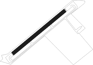
Runway info
| Runway 05 / 23 | ||
| length | 480m (1575ft) | |
| bearing | 62° / 242° | |
| width | 27m (89ft) | |
| surface | asphalt | |
Nearby beacons
| code | identifier | dist | bearing | frequency |
|---|---|---|---|---|
| CEK | CEKMECE NDB | 5.9 | 192° | 328 |
| ST | ATATURK (ISTANBUL) NDB | 14.2 | 119° | 340 |
| UHL | UHL VOR/DME | 14.3 | 37° | 110 |
| IST | ISTANBUL VORTAC | 14.5 | 119° | 112.50 |
| UHM | UHM VOR/DME | 14.6 | 41° | 108.25 |
| UHN | UHN VOR/DME | 15.4 | 45° | 109.85 |
| BKZ | BEYKOZ VOR/DME | 26.8 | 88° | 117.30 |
| CRL | CORLU VOR/DME | 27.9 | 274° | 114.80 |
| CLU | CORLU TACAN | 28.3 | 274° | 115.90 |
| CRL | CORLU NDB | 28.9 | 272° | 426 |
| SAB | SABIHA NDB | 37.3 | 104° | 347 |
| SBH | SABIHA (ISTANBUL) VOR/DME | 37.3 | 104° | 108.80 |
| YAA | YALOVA VOR/DME | 48.1 | 134° | 117.70 |
| BDM | BANDIRMA TACAN | 53.8 | 216° | 111 |
Disclaimer
The information on this website is not for real aviation. Use this data with the X-Plane flight simulator only! Data taken with kind consent from X-Plane 12 source code and data files. Content is subject to change without notice.