Diyarbakir - Diyarbakir Ab
Airport details
| Country | Turkey |
| State | Diyarbakir Province |
| Region | LT |
| Airspace | Ankara Ctr |
| Municipality | Bağlar |
| Elevation | 2250ft (686m) |
| Timezone | GMT +3 |
| Coordinates | 37.90447, 40.19949 |
| Magnetic var | |
| Type | land |
| Available since | X-Plane v10.40 |
| ICAO code | LTCC |
| IATA code | DIY |
| FAA code | n/a |
Communication
| Diyarbakir AB ATIS | 122.425 |
| Diyarbakir AB Approach | 122.100 |
| Diyarbakir AB Tower | 118.100 |
Approach frequencies
| ILS-cat-I | RW34 | 108.5 | 18.00mi |
| 3° GS | RW34 | 108.5 | 18.00mi |
Nearby Points of Interest:
Diyarbakır Fortress and Hevsel Gardens Cultural Landscape
-Diyarbakır Fortress
-Hevsel Gardens
-Devegeçidi Dam
-Karaca Dağ
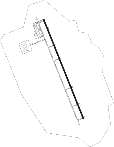
Runway info
| Runway 16 / 34 | ||
| length | 3553m (11657ft) | |
| bearing | 158° / 338° | |
| width | 45m (148ft) | |
| surface | concrete | |
| blast zone | 154m (505ft) / 255m (837ft) | |
Nearby beacons
| code | identifier | dist | bearing | frequency |
|---|---|---|---|---|
| DIY | DIYARBAKIR TACAN | 0.4 | 214° | 110 |
| DYB | DIYARBAKIR NDB | 1.9 | 164° | 330 |
| BAT | BATMAN NDB | 43.6 | 88° | 470 |
| MRD | MARDIN NDB | 45.7 | 147° | 403 |
| ELG | KEBAN NDB | 59.9 | 307° | 338 |
| BNG | BINGOL NDB | 60.1 | 23° | 384 |
| EZS | ELAZIG VOR/DME | 66.6 | 309° | 114.70 |
| KML | KAMISHLY VOR/DME | 71 | 132° | 115.10 |
Departure and arrival routes
| Transition altitude | 10000ft |
| SID end points | distance | outbound heading | |
|---|---|---|---|
| RW16 | |||
| SUMA1X, SUMA1W | 23mi | 62° | |
| LEKR1W, LEKR1X | 53mi | 129° | |
| ATLO1W, ATLO1X | 51mi | 239° | |
| DEME1X, DEME1W | 50mi | 251° | |
| MOVU1W, MOVU1X | 48mi | 284° | |
| ZUIT1W, ZUIT1X | 38mi | 309° | |
| RW34 | |||
| SUMA1J, SUMA1Y | 23mi | 62° | |
| LEKR1J, LEKR1Y | 53mi | 129° | |
| ATLO1Y, ATLO1J | 51mi | 239° | |
| DEME1Y, DEME1J | 50mi | 251° | |
| MOVU1J, MOVU1Y | 48mi | 284° | |
| ZUIT1J, ZUIT1Y | 38mi | 309° | |
| STAR starting points | distance | inbound heading | |
|---|---|---|---|
| RW16 | |||
| ATLO1B, ATLO1D | 65.7 | 59° | |
| MOVU1B, MOVU1D | 55.8 | 105° | |
| ZUIT1D, ZUIT1B | 52.2 | 129° | |
| SUMA1B, SUMA1D | 35.4 | 241° | |
| LEKR1D, LEKR1B | 70.0 | 309° | |
| RW34 | |||
| ATLO1A, ATLO1C | 65.7 | 59° | |
| MOVU1C, MOVU1A | 55.8 | 105° | |
| ZUIT1A, ZUIT1C | 52.2 | 129° | |
| SUMA1A, SUMA1C | 35.4 | 241° | |
| LEKR1C, LEKR1A | 70.0 | 309° | |
Holding patterns
| STAR name | hold at | type | turn | heading* | altitude | leg | speed limit |
|---|---|---|---|---|---|---|---|
| ATLO1A | DYB | NDB | right | 158 (338)° | > 5000ft | 1.0min timed | 230 |
| ATLO1B | DYB | NDB | right | 158 (338)° | > 5000ft | 1.0min timed | 230 |
| ATLO1C | DYB | NDB | right | 158 (338)° | > 5000ft | 1.0min timed | 230 |
| ATLO1D | DYB | NDB | right | 158 (338)° | > 5000ft | 1.0min timed | 230 |
| DEME1A | DYB | NDB | right | 158 (338)° | > 5000ft | 1.0min timed | 230 |
| DEME1D | DYB | NDB | right | 158 (338)° | > 5000ft | 1.0min timed | 230 |
| LEKR1A | DYB | NDB | right | 158 (338)° | > 5000ft | 1.0min timed | 230 |
| LEKR1B | DYB | NDB | right | 158 (338)° | > 5000ft | 1.0min timed | 230 |
| LEKR1C | DYB | NDB | right | 158 (338)° | > 5000ft | 1.0min timed | 230 |
| LEKR1D | DYB | NDB | right | 158 (338)° | > 5000ft | 1.0min timed | 230 |
| MOVU1A | DYB | NDB | right | 158 (338)° | > 5000ft | 1.0min timed | 230 |
| MOVU1B | DYB | NDB | right | 158 (338)° | > 5000ft | 1.0min timed | 230 |
| MOVU1C | DYB | NDB | right | 158 (338)° | > 5000ft | 1.0min timed | 230 |
| MOVU1D | DYB | NDB | right | 158 (338)° | > 5000ft | 1.0min timed | 230 |
| SUMA1A | DYB | NDB | right | 158 (338)° | > 5000ft | 1.0min timed | 230 |
| SUMA1B | DYB | NDB | right | 158 (338)° | > 5000ft | 1.0min timed | 230 |
| SUMA1C | DYB | NDB | right | 158 (338)° | > 5000ft | 1.0min timed | 230 |
| SUMA1D | DYB | NDB | right | 158 (338)° | > 5000ft | 1.0min timed | 230 |
| ZUIT1A | DYB | NDB | right | 158 (338)° | > 5000ft | 1.0min timed | 230 |
| ZUIT1B | DYB | NDB | right | 158 (338)° | > 5000ft | 1.0min timed | 230 |
| ZUIT1C | DYB | NDB | right | 158 (338)° | > 5000ft | 1.0min timed | 230 |
| ZUIT1D | DYB | NDB | right | 158 (338)° | > 5000ft | 1.0min timed | 230 |
| *) magnetic outbound (inbound) holding course | |||||||
Disclaimer
The information on this website is not for real aviation. Use this data with the X-Plane flight simulator only! Data taken with kind consent from X-Plane 12 source code and data files. Content is subject to change without notice.