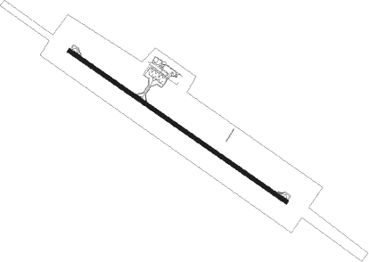
Igdir
Airport details
| Country | Turkey |
| State | Igdir |
| Region | LT |
| Airspace | Ankara Ctr |
| Municipality | Iğdır Merkez |
| Elevation | 3101ft (945m) |
| Timezone | GMT +3 |
| Coordinates | 39.97556, 43.87833 |
| Magnetic var | |
| Type | land |
| Available since | X-Plane v10.40 |
| ICAO code | LTCT |
| IATA code | IGD |
| FAA code | n/a |
Communication
| Igdir Ground Control | 121.800 |
| Igdir Tower | 121.300 |
| Igdir Approach | 119.600 |
Approach frequencies
| LOC | RW12 | 108.35 | 18.00mi |
Nearby beacons
| code | identifier | dist | bearing | frequency |
|---|---|---|---|---|
| GDR | IGDIR NDB | 0.4 | 110° | 388 |
| ZVR | ZVARTNOTS VOR/DME | 23.5 | 70° | 112.30 |
| FH | EREBUNI (YEREVAN) NDB | 23.7 | 80° | 465 |
| YN | EREBUNI (YEREVAN) NDB | 26.8 | 78° | 580 |
| Y | EREBUNI (YEREVAN) NDB | 27.4 | 77° | |
| ER | EREBUNI (YEREVAN) NDB | 29.5 | 74° | 496 |
| ARI | AGRI NDB | 43.9 | 249° | 289 |
| GM | SHIRAK (GYUMRI) NDB | 45.2 | 358° | 668 |
| KAR | KARS NDB | 49.7 | 307° | 431 |
Departure and arrival routes
| Transition altitude | 19000ft |
| SID end points | distance | outbound heading | |
|---|---|---|---|
| RW12 | |||
| ULKU1A | 44mi | 249° | |
| YAVU1A | 67mi | 273° | |
| RW30 | |||
| ETIS1A | 30mi | 291° | |
| STAR starting points | distance | inbound heading | |
|---|---|---|---|
| ALL | |||
| ULKU1B | 43.9 | 69° | |
| YAVU1B | 66.5 | 93° | |
| BIRZ1B | 43.7 | 96° | |
| ASKA1B | 47.1 | 98° | |
Instrument approach procedures
| runway | airway (heading) | route (dist, bearing) |
|---|---|---|
| RW12 | ELTOX (104°) | ELTOX 12000ft MODRI (7mi, 87°) 8960ft |
| RNAV | MODRI 8960ft VAKSO (7mi, 109°) 7220ft EKMEV (6mi, 109°) 4820ft MA12 (4mi, 109°) 3426ft CT110 (4mi, 109°) CT120 (7mi, 97°) CT130 (5mi, 192°) CT140 (10mi, 277°) ELTOX (26mi, 294°) 12000ft ELTOX (turn) 12000ft | |
| RW30 | ELTOX (104°) | ELTOX 12000ft NEVGU (12mi, 115°) 12000ft GEKNO (9mi, 91°) 11000ft VESUT (15mi, 92°) 7430ft BATMO (5mi, 192°) 6220ft |
| RW30 | ULKUR (69°) | ULKUR 14000ft NEVGU (15mi, 42°) 12000ft GEKNO (9mi, 91°) 11000ft VESUT (15mi, 92°) 7430ft BATMO (5mi, 192°) 6220ft |
| RNAV | BATMO 6220ft ASNAV (5mi, 277°) 4960ft LTCT (6mi, 302°) 3109ft CT201 (5mi, 302°) CT202 (5mi, 279°) CT203 (6mi, 304°) ELTOX (10mi, 267°) 12000ft ELTOX (turn) 12000ft |
Holding patterns
| STAR name | hold at | type | turn | heading* | altitude | leg | speed limit |
|---|---|---|---|---|---|---|---|
| ULKU1B | GDR | NDB | left | 123 (303)° | > 14000ft | DME 12.0mi | ICAO rules |
| YAVU1B | GDR | NDB | left | 123 (303)° | > 14000ft | DME 12.0mi | ICAO rules |
| *) magnetic outbound (inbound) holding course | |||||||
Disclaimer
The information on this website is not for real aviation. Use this data with the X-Plane flight simulator only! Data taken with kind consent from X-Plane 12 source code and data files. Content is subject to change without notice.
