Şırnak - Sirnak
Airport details
| Country | Turkey |
| State | Şırnak Province |
| Region | LT |
| Airspace | Ankara Ctr |
| Municipality | İdil |
| Elevation | 2038ft (621m) |
| Timezone | GMT +3 |
| Coordinates | 37.36389, 42.06000 |
| Magnetic var | |
| Type | land |
| Available since | X-Plane v10.40 |
| ICAO code | LTCV |
| IATA code | NKT |
| FAA code | n/a |
Communication
| Sirnak Sirnak Ground | 121.600 |
| Sirnak Sirnak Tower | 119.550 |
| Sirnak Sirnak Approach | 119.200 |
Approach frequencies
| ILS-cat-I | RW11 | 108.35 | 18.00mi |
| 3° GS | RW11 | 108.35 | 18.00mi |
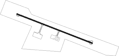
Runway info
| Runway 11 / 29 | ||
| length | 2996m (9829ft) | |
| bearing | 111° / 291° | |
| width | 45m (148ft) | |
| surface | concrete | |
| blast zone | 61m (200ft) / 62m (203ft) | |
Nearby beacons
| code | identifier | dist | bearing | frequency |
|---|---|---|---|---|
| RNA | SIRNAK NDB | 0 | 50° | 411 |
| SRT | SIIRT VOR/DME | 33.9 | 342° | 114.30 |
| SIR | SIIRT NDB | 38.3 | 340° | 409 |
| KML | KAMISHLY NDB | 45.5 | 249° | 312 |
| KML | KAMISHLY VOR/DME | 46.7 | 248° | 115.10 |
| BAT | BATMAN NDB | 56.4 | 301° | 470 |
Departure and arrival routes
| Transition altitude | 12000ft |
| SID end points | distance | outbound heading | |
|---|---|---|---|
| RW11 | |||
| ABDI1C, ABDI1E | 20mi | 342° | |
| RW29 | |||
| ULSA1A | 64mi | 310° | |
| ABDI1B, ABDI1D | 20mi | 342° | |
| STAR starting points | distance | inbound heading | |
|---|---|---|---|
| ALL | |||
| ABDI1A | 20.1 | 162° | |
Holding patterns
| STAR name | hold at | type | turn | heading* | altitude | leg | speed limit |
|---|---|---|---|---|---|---|---|
| ABDI1A | RNA | NDB | right | 81 (261)° | > 9000ft | 1.0min timed | ICAO rules |
| *) magnetic outbound (inbound) holding course | |||||||
Disclaimer
The information on this website is not for real aviation. Use this data with the X-Plane flight simulator only! Data taken with kind consent from X-Plane 12 source code and data files. Content is subject to change without notice.