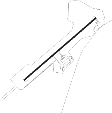
Edremit - Balikesir Koca Seyit
Airport details
| Country | Turkey |
| State | Balıkesir Province |
| Region | LT |
| Airspace | Istanbul Ctr |
| Municipality | Burhaniye |
| Elevation | 68ft (21m) |
| Timezone | GMT +3 |
| Coordinates | 39.55250, 27.01028 |
| Magnetic var | |
| Type | land |
| Available since | X-Plane v10.32 |
| ICAO code | LTFD |
| IATA code | EDO |
| FAA code | n/a |
Communication
| Balikesir Koca Seyit Tower | 121.900 |
| Balikesir Koca Seyit Tower | 119.700 |
Approach frequencies
| ILS-cat-I | RW05 | 108.9 | 18.00mi |
| 3° GS | RW05 | 108.9 | 18.00mi |
Nearby Points of Interest:
Mount Ida
-Ayvalık
Nearby beacons
| code | identifier | dist | bearing | frequency |
|---|---|---|---|---|
| EDR | EDREMIT NDB | 0.2 | 252° | 368 |
| LSV | LESVOS VOR/DME | 33.3 | 241° | 114.20 |
| MLN | MITILINI VOR/DME | 35.3 | 220° | 109.60 |
| LVO | MITILINI NDB | 35.5 | 219° | 397 |
| BRI | BALIKESIR NDB | 42.7 | 85° | 470 |
| CNK | CANAKKALE NDB | 44.1 | 315° | 422 |
| BIG | BIGA VOR/DME | 46.9 | 26° | 116.90 |
| AKI | AKHISAR TACAN | 58.1 | 132° | 110.20 |
| BDM | BANDIRMA TACAN | 64.1 | 52° | 111 |
Departure and arrival routes
| Transition altitude | 10000ft |
| SID end points | distance | outbound heading | |
|---|---|---|---|
| RW05 | |||
| BIMD1U | 27mi | 23° | |
| LEDL1U | 25mi | 39° | |
| KONE1C, KONE1A | 20mi | 46° | |
| DUGL1U, DUGL1A | 10mi | 104° | |
| RW23 | |||
| KONE1B, KONE1M | 20mi | 46° | |
| DUGL1B, DUGL1M | 10mi | 104° | |
| STAR starting points | distance | inbound heading | |
|---|---|---|---|
| ALL | |||
| KONE1D | 19.8 | 226° | |
| DUGL1D | 10.4 | 284° | |
| RW05 | |||
| KONE1T | 19.8 | 226° | |
| DUGL1T | 10.4 | 284° | |
| RW23 | |||
| LEDL1K | 25.2 | 219° | |
| EKSI1K | 34.0 | 223° | |
| DUGL1L, DUGL1K | 10.4 | 284° | |
Holding patterns
| STAR name | hold at | type | turn | heading* | altitude | leg | speed limit |
|---|---|---|---|---|---|---|---|
| DUGL1D | EDR | NDB | left | 48 (228)° | > 6500ft | 1.0min timed | 210 |
| DUGL1K | DUGLA | VHF | left | 212 (32)° | > 5700ft | 1.0min timed | 230 |
| DUGL1L | DUGLA | VHF | left | 212 (32)° | > 5700ft | 1.0min timed | 230 |
| EKSI1K | EKSIB | VHF | left | 14 (194)° | > 8500ft | 1.0min timed | 230 |
| KONE1D | EDR | NDB | left | 48 (228)° | > 6500ft | 1.0min timed | 210 |
| *) magnetic outbound (inbound) holding course | |||||||
Disclaimer
The information on this website is not for real aviation. Use this data with the X-Plane flight simulator only! Data taken with kind consent from X-Plane 12 source code and data files. Content is subject to change without notice.