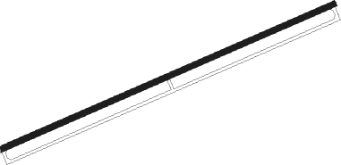
Mărculeşti - Markuleshty
Airport details
| Country | Moldova |
| State | Floreşti |
| Region | LU |
| Airspace | Chisinau Ctr |
| Municipality | Florești District |
| Elevation | 312ft (95m) |
| Timezone | GMT +2 |
| Coordinates | 47.86262, 28.21287 |
| Magnetic var | |
| Type | land |
| Available since | X-Plane v10.40 |
| ICAO code | LUBM |
| IATA code | n/a |
| FAA code | n/a |
Communication
Nearby Points of Interest:
Rădoaia
-Park of Cubolta
-Outcrop in the Soloneț block
-Windbreak of Bălți
-Edificiu pentru funcții cultural-sociale
-Park of Temeleuți
-Cușelăuca monastery
-Park of Cuhureștii de Sus
-Biserica Sfânta Treime din Cuhureștii de Sus
-Bogdan mansion in Cuhureștii de Sus
-Springs of Ordășei
-Sector de stepă a Bălților
-Body of water on Ciuluc river
-Bechirov Iar
-Dobrușa landscape reserve
-Oak of Stephen the Great in Cobîlea
-Răspopeni outcrop
-Upper Proterozoic outcrop near Cerlina
-Cosăuți landscape reserve
-Springs of Cotova
-Spring of Sămășcani
-Japca cliff
-Former excavation site near Șoldănești train station
-Pragurile Nistrului
-"La Moară" lakes
Nearby beacons
| code | identifier | dist | bearing | frequency |
|---|---|---|---|---|
| LC | BALTI NDB | 17.9 | 269° | 389 |
| LCT | BALTI NDB | 18.7 | 272° | 790 |
| ISI | IASI NDB | 45.6 | 225° | 351 |
| IAS | IASI NDB | 48 | 219° | 384 |
| KIV | CHISINAU VOR/DME | 62.8 | 144° | 113.70 |
Departure and arrival routes
| Transition altitude | 4000ft |
| SID end points | distance | outbound heading | |
|---|---|---|---|
| RW07 | |||
| ATRE1H | 41mi | 89° | |
| ERAD1H | 25mi | 181° | |
| UNIR1H | 44mi | 207° | |
| INRO1H | 65mi | 292° | |
| UNDO1H | 41mi | 320° | |
| RW25 | |||
| ATRE1J | 41mi | 89° | |
| ERAD1J | 25mi | 181° | |
| UNIR1J | 44mi | 207° | |
| INRO1J | 65mi | 292° | |
| UNDO1J | 41mi | 320° | |
| STAR starting points | distance | inbound heading | |
|---|---|---|---|
| RW07 | |||
| ERAD1B | 25.4 | 1° | |
| UNIR1B | 44.1 | 27° | |
| INRO1B | 65.1 | 112° | |
| UNDO1B | 40.5 | 140° | |
| LAVD1B | 26.1 | 243° | |
| RW25 | |||
| ERAD1F | 25.4 | 1° | |
| UNIR1F | 44.1 | 27° | |
| INRO1F | 65.1 | 112° | |
| UNDO1F | 40.5 | 140° | |
| LAVD1F | 26.1 | 243° | |
Instrument approach procedures
| runway | airway (heading) | route (dist, bearing) |
|---|---|---|
| RW07 | BM301 (257°) | BM301 BM302 (12mi, 273°) 3000ft BM303 (5mi, 257°) 3000ft BM304 (5mi, 153°) 3000ft BM305 (5mi, 77°) 2500ft |
| RW07 | BM304 (77°) | BM304 3000ft BM305 (5mi, 77°) 2500ft |
| RNAV | BM305 2500ft BM306 (7mi, 77°) 346ft BM307 (10mi, 77°) 2300ft BM301 (6mi, 257°) 3000ft | |
| RW25 | BM301 (257°) | BM301 BM308 (6mi, 116°) 3000ft BM309 (5mi, 77°) 3000ft BM310 (5mi, 333°) 3000ft BM311 (5mi, 257°) 2500ft |
| RW25 | BM310 (257°) | BM310 3000ft BM311 (5mi, 257°) 2500ft |
| RNAV | BM311 2500ft BM312 (7mi, 257°) 381ft BM313 (8mi, 257°) 1600ft BM301 (11mi, 77°) 3000ft |
Holding patterns
| STAR name | hold at | type | turn | heading* | altitude | leg | speed limit |
|---|---|---|---|---|---|---|---|
| ERAD1B | BM301 | VHF | right | 244 (64)° | > 4000ft | 1.0min timed | ICAO rules |
| ERAD1F | BM301 | VHF | right | 244 (64)° | > 4000ft | 1.0min timed | ICAO rules |
| INRO1F | BM301 | VHF | right | 244 (64)° | > 4000ft | 1.0min timed | ICAO rules |
| LAVD1B | BM301 | VHF | right | 244 (64)° | > 4000ft | 1.0min timed | ICAO rules |
| UNDO1B | BM301 | VHF | right | 244 (64)° | > 4000ft | 1.0min timed | ICAO rules |
| UNDO1F | BM301 | VHF | right | 244 (64)° | > 4000ft | 1.0min timed | ICAO rules |
| UNIR1F | BM301 | VHF | right | 244 (64)° | > 4000ft | 1.0min timed | ICAO rules |
| *) magnetic outbound (inbound) holding course | |||||||
Disclaimer
The information on this website is not for real aviation. Use this data with the X-Plane flight simulator only! Data taken with kind consent from X-Plane 12 source code and data files. Content is subject to change without notice.
